NOTE: This app will not be available in the Play Store for much longer. We recommend the Rother app instead. If you have saved your own tours, you can still export them now.
To the Rother app:
https://play.google.com/store/apps/details?id=de.komoot.rother_touren
Mobile phone app PhoneMaps offers FOR FREE zoomable hiking and cycling maps with full network of marked hiking and cycling routes of almost whole Europe. In app you can plan your holiday, during the activity orientate in terrain and record your tracks and experiences and then share them with your friends. Hiking or cycling content with marked hiking/cycling routes you will not find in general map applications in your phone, you will not need to go to bookshop and buy paper map.
- Language: English, German, Czech, Slovak, Polish, Italian, Dutch, Slovenian, Portuguese, Chinese
- Online and offline maps
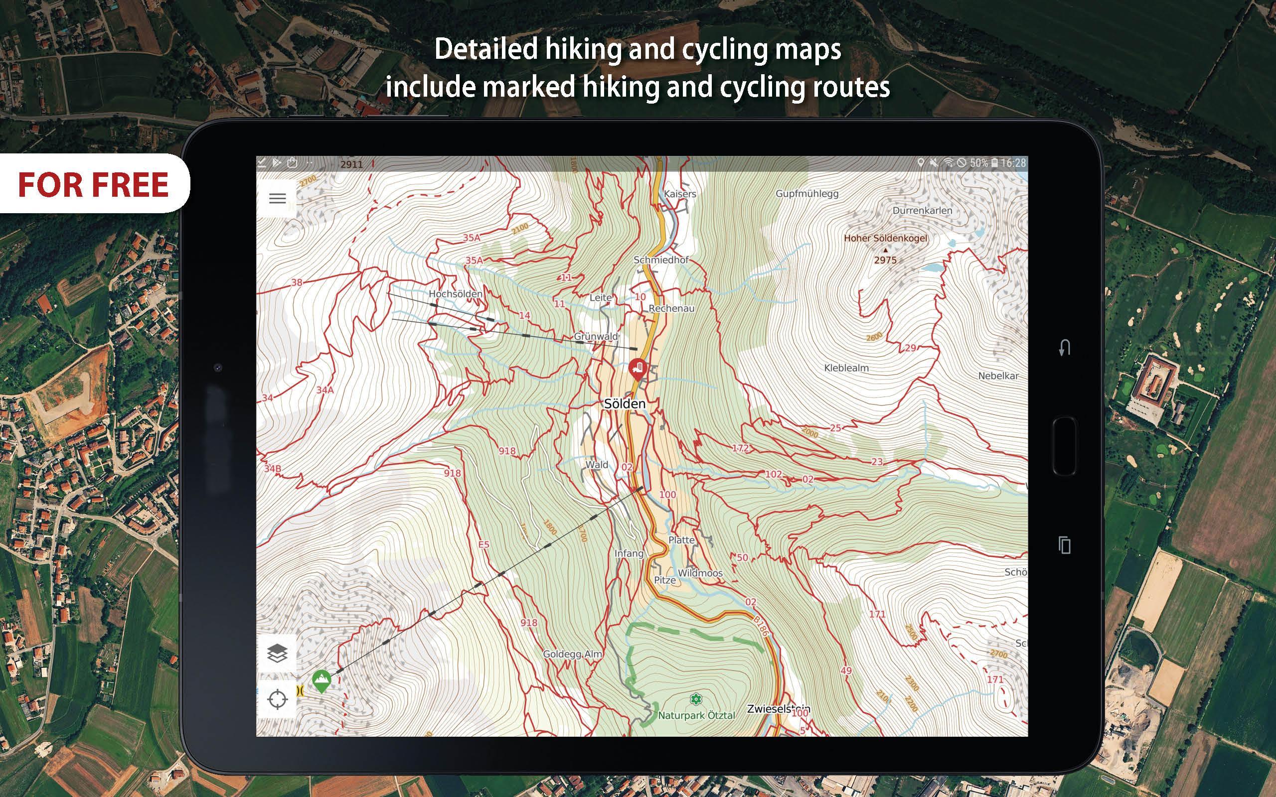
- Detailed hiking and cycling maps include marked hiking and cycling routes, ski maps, road maps, maps for mountain bikes
- Maps created by cartographic companies freytag&berndt and SHOCart
- Hiking and travel guides from Bergverlag Rother, freytag&berndt
- Vector maps: smaller, can be easily zoomable and rotated
- Download map of area where you will go, map tiles are displayed as one map
- All points in maps with interactive information (address, website, email, timetable, ....)
- Interactive tourist attractions in maps (photos and texts)
- Current GPS position
- Locality searching
- Record/import/export/management of user routes (gpx)
- Record user Points of interest
- Spatially localized taking photos in app
- Online routing and searching of optimal routes in a map (for hikers, cyclers, cars)
- Statistics of routes + elevation models of routes
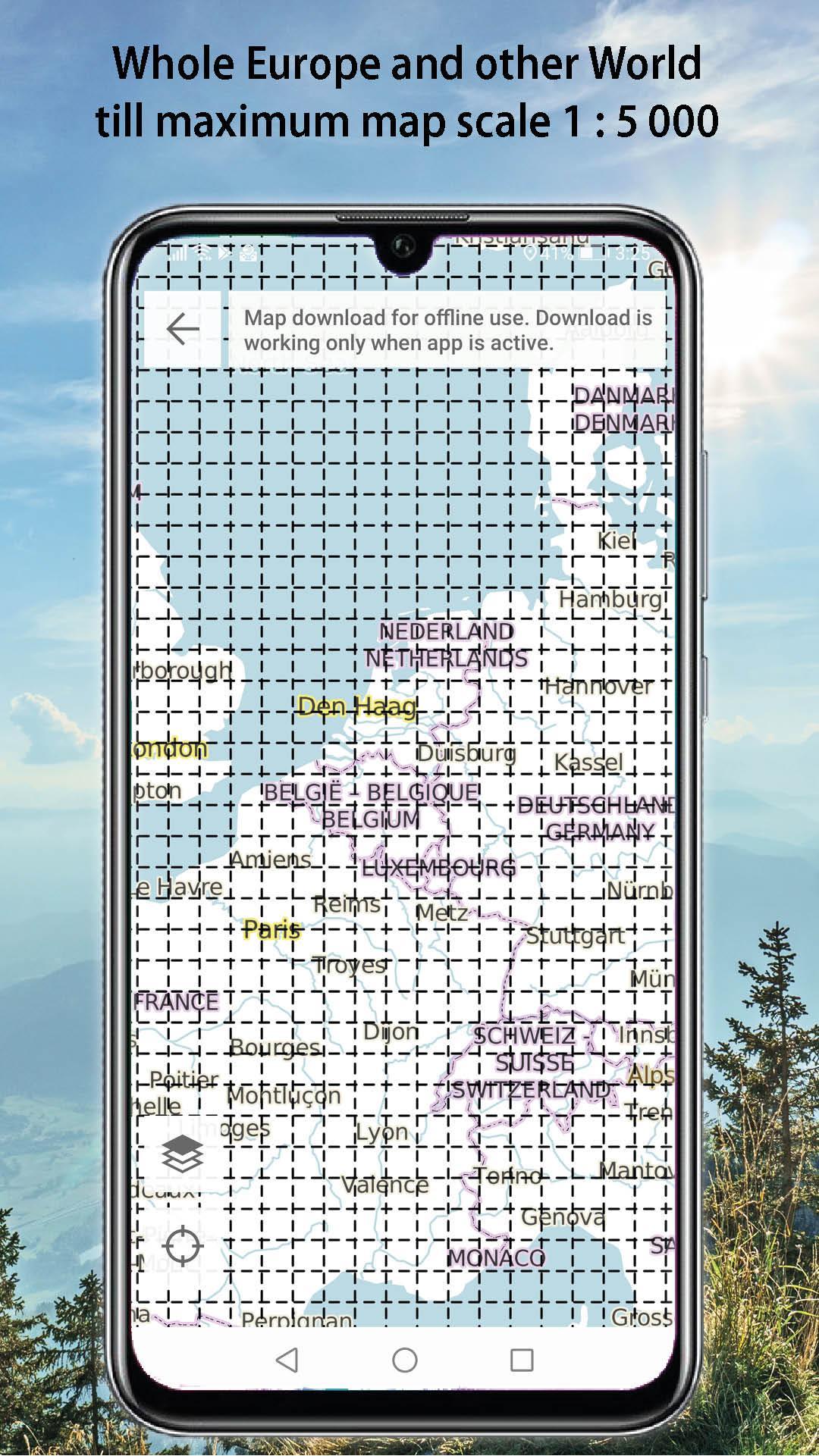
- Hiking / cycling map till 1:5 000 - Andorra, Austria, Belgium, Bulgaria, Croatia, Czech Republic, Denmark, Estonia, Finland, France, Germany, Greece, Ireland, Italy, Hungary, Latvia, Lichtenstein, Lithuania, Luxembourg, Monaco, Montenegro, Netherlands, Norway, Poland, Romania, San Marino, Spain, Slovakia, Slovenia, Sweden, Switzerland, United Kingdom, USA, Nepal, Japan, Taiwan, New Zealand, Israel, Kilimanjaro
- Topographic map 1:5 000 - rest of the world
AND THE BEST THING IS THAT APP AND ALL MAPS AND FUNCTIONS IN APP ARE FOR FREE!
Latest Version
100.0Uploaded by
Thakor Jigar
Requires Android
Android 4.0.3+
Category
Free Travel & Local AppContent Rating
Everyone
Report
Flag as inappropriateLast updated on Aug 18, 2020
New data network models for routing for hiking, cycling and motorists.
Map key changefor better visibility and easier map reading
Individual symbols for marked hiking routes in Germany.
New vector map style: MTB map with difficulty of recommended trails
Bug fixes


APKPure - A multi-platform app store primarily focused on Android, providing extensive app-related content. Discover the app you want easier, faster, and safer, with quick and efficient downloads and installations.


