Scan Date:May 7, 2026
Show More
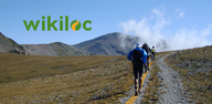
The Outdoors Community App.
Wikiloc is the go-to outdoor navigation application for hiking, cycling, and over 80 other outdoor activities with millions of members worldwide. Find your favorite trails among authentic routes created by the community, record your own and share it, easily transfer it to your GPS device, and more features to enjoy nature whenever you want.
Engage in outdoor sports:
Choose from 50 million hiking, trekking, biking (MTB, road cycling, gravel), trail running, mountaineering, climbing, kayaking, skiing, and up to 80 different types of activities.
Authentic nature trails:
Wikiloc routes have been recorded with GPS and created by community members — nature and outdoor sports enthusiasts like you.
Send routes to your GPS or smartwatch:
Enjoy the experience from your wrist or mobile. Download Wikiloc routes directly to your Wear OS, Garmin, Suunto or COROSsports watch or bike computer.
Available for devices like Garmin Forerunner, Fenix, Epix, Edge, and many more. You can also record and follow routes on a map from your Samsung Galaxy Watch, Pixel Watch, Fossil, Oneplus, Xiaomi, or TicWatch (minimum Wear OS 3 version).
Outdoor Navigation: stay on track:
✅ Turn your mobile phone or smartwatch into a GPS navigator. Your smartphone will guide you with a direction indicator and sound alerts to notify you if you stray off the path during navigation.
✅ Live GPS route tracking. Share your real-time location with family and friends while you're on the route, so they know where you are at all times.
✅ Offline GPS navigation through free topographic maps worldwide for use without coverage or data. Ideal for when you're in the mountains or traveling without an internet connection or with a low battery.
Official routes for all audiences 🏔️🥾♿
Explore free GPS walking routes through national parks (including routes adapted for reduced mobility and visual impairment), trekking on mountain trails, routes by waterfalls, and more in the largest hiking and cycling community (or bike trails) around you.
Follow local iconic routes on foot or climb the most famous mountain passes. Become part of the community where millions of nature, travel, and sports lovers share their adventures, from the most popular hike to the most remote trekking expedition on the planet.
Find the perfect route for your next adventure, through Premium features such as:
✅ Route Planner: Plan your next adventure easily. Simply choose the places you want to pass through and Wikiloc will create a route prioritizing the most popular stretches of trails from other community members.
✅ 3D Maps: Explore trails with more depth and detail. Without leaving home, discover the terrain relief, evaluate elevation changes, and take a look at the panoramic views that await you along the way.
✅ Advanced search filters: by elevation gain, distance, difficulty, and season (winter/summer).
✅ Search by passing area: find routes that pass through the places of interest you choose and plan your ideal itinerary.
✅ Weather forecast for a perfect outing.
Create and share your adventures
Record your own outdoor routes on a map, add waypoints, take photos of the landscapes along the itinerary, and upload them to your Wikiloc account from your mobile phone. Share your adventures with friends, family, and community followers.
Commitment to the planet
With Wikiloc Premium, you not only help us continue to improve Wikiloc, but you also contribute to protecting the Earth, as 1% of your purchase goes directly to 1% for the Planet, a global network of companies, nonprofit organizations, and individuals working together for a healthy planet.f
Latest Version
3.58.15Uploaded by
Crislyn Piala
Requires Android
Category
Free Maps & Navigation AppContent Rating
Everyone
Security Report
Report
Flag as inappropriateLast updated on May 22, 2026
Minor bug fixes and improvements. Install or update to the newest version to check it out!


APKPure - A multi-platform app store primarily focused on Android, providing extensive app-related content. Discover the app you want easier, faster, and safer, with quick and efficient downloads and installations.