Scan Date:Feb 13, 2026
Show More
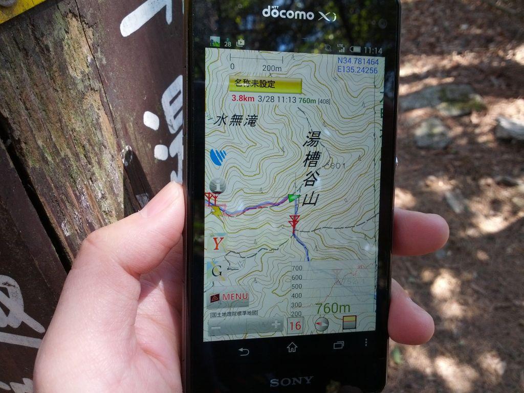
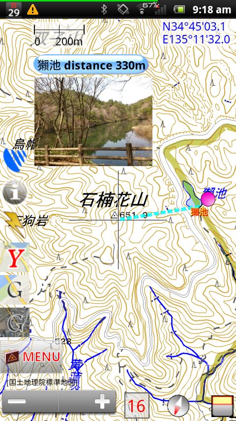
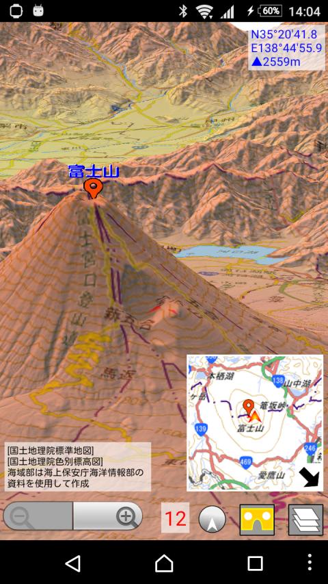
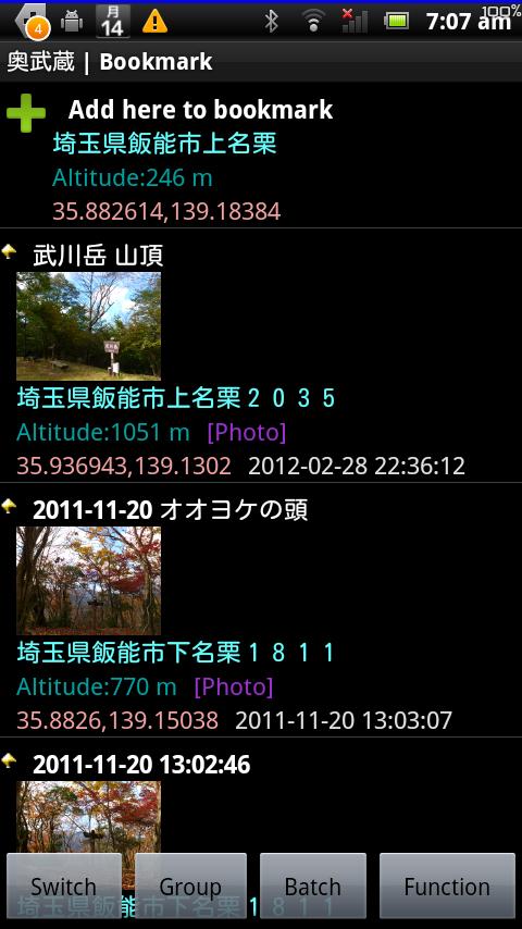
Japanese topographical map viewer for Android.
If you want to see other country, please select OpenStreetMap at
Menu -> Map Manage ->Map Mode
We use the tile according to the rules of Geospatial Information Authority of Japan.
Functions
-Topographical map (Japan only. Tile of Geospatial Information Authority of Japan.)
-OpenStreetMap
-Web map tile
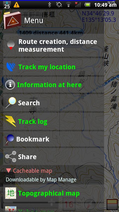
-GPS location search
-Bookmark (You can record POI)
-Distance measurement
-Route creation (route of straight line, route)
-Import GPX file (Please send GPX file from file manager application)
Icons by Orion Icon Library - https://orioniconlibrary.com
Smart Connect extension for SmartWatch 2
Latest Version
20.2-VRUploaded by
Feezalah Rahmane
Requires Android
Android 5.0+
Category
Free Travel & Local AppContent Rating
Everyone
Security Report
Report
Flag as inappropriateLast updated on Feb 13, 2026
Version 20.2 (2026/2/12)
-Fix bug when sharing location from Google Maps.
Version 20.1 (2025/11/24)
-Fix color scheme at Google map mode.
Version 20.0 (2025/9/30)
-On Android 11 and above, you can now set the transparency of the status bar background at the top of the screen.
-Adapted to Google Play's requirement which start at the second half of 2025 (targetAPI level36, 16KB page mode)
-Improvements and bug fixes.

APKPure - A multi-platform app store primarily focused on Android, providing extensive app-related content. Discover the app you want easier, faster, and safer, with quick and efficient downloads and installations.


