Package Name:id.web.pitwise
SHA-256:f271aa83d50da5cac865db3c380f7ec8d2d3483a7c2dd43964427ad76aac6455
Show More
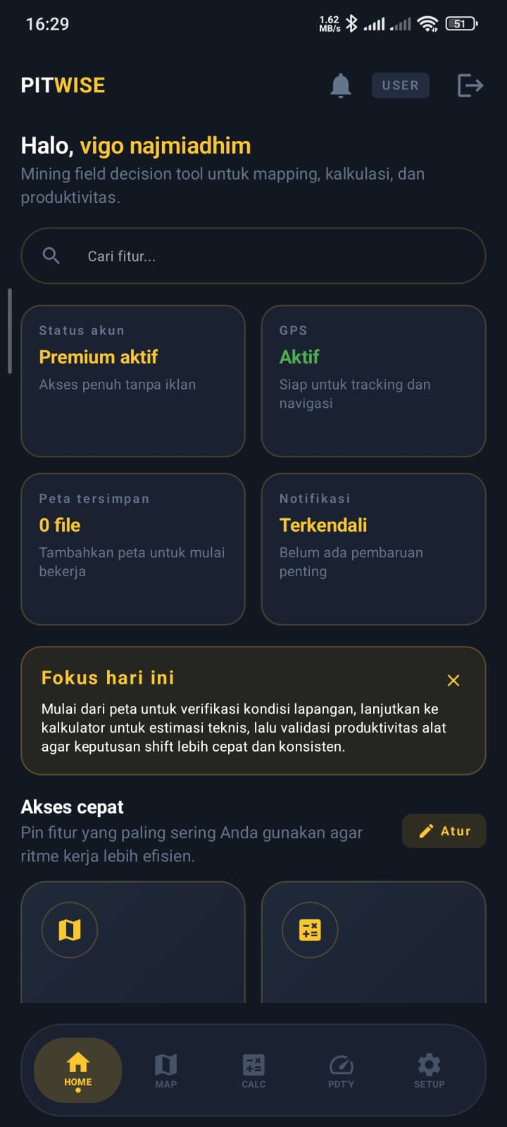
PITWISE is a comprehensive mining calculator and field toolkit designed specifically for Mining Engineers, Surveyors, Field Supervisors, and earthwork professionals.
Leave behind time-consuming methods. With PITWISE, you can perform technical calculations for open-pit mine operations, evaluate heavy equipment productivity, and analyze spatial data directly from your smartphone, anytime, anywhere.
PITWISE'S TOP FEATURES:
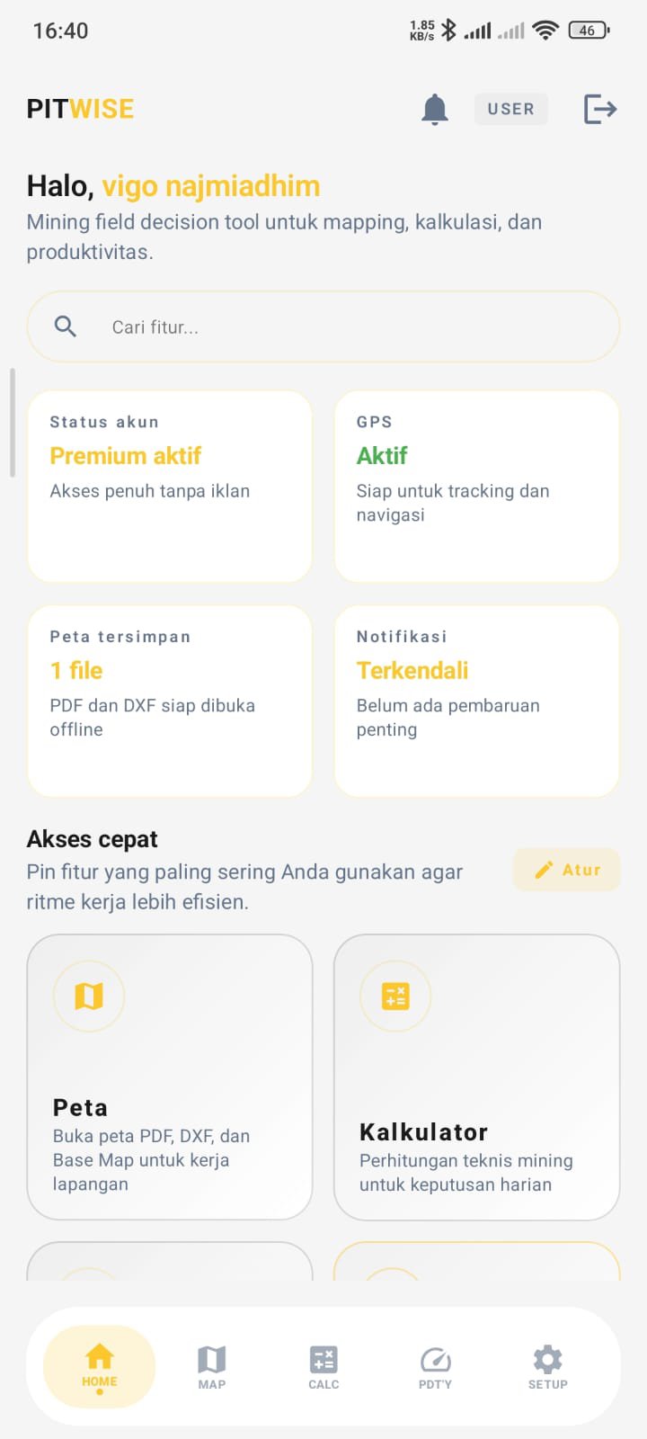
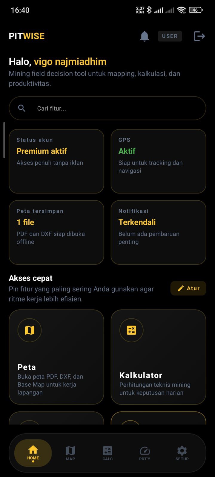
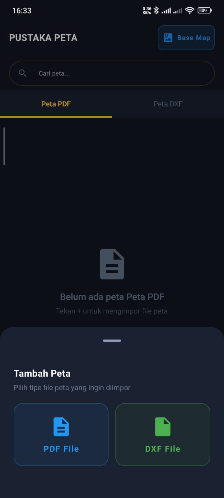
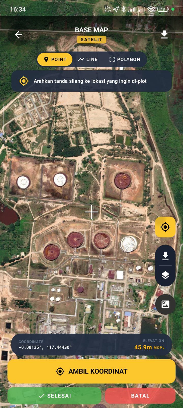
🗺️ Mapping, Navigation & Spatial (GIS)
Open Multi-Format Maps: Supports PDF Orthographic, Basemap, and DXF map files.
Polygon & Line Management: Plot points, draw, and measure (polylines and polygons).
Flexible Import & Export: Save and open spatial data in KMZ, KML, and DXF formats.
Field Navigation: Track your journey and navigate with high precision to your destination.
Coordinate Converter: Quickly convert coordinates in the field.
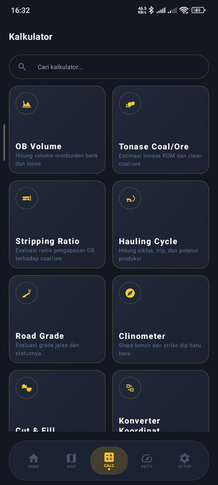
⛏️ Mine Volume & Geometry Calculation
Reserve & Seam Estimation: Calculate Overburden (OB) and Coal/Ore Volume.
Feasibility Analysis: Quickly calculate the Stripping Ratio (SR).
Design & Earthworks: Calculate Cut and Fill and Mine Road Grade.
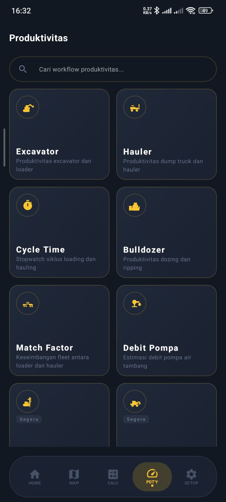
🚜 Heavy Equipment Productivity & Hauling
Circle Time Analysis: Accurately calculate Cycle Time and Hauling Cycle.
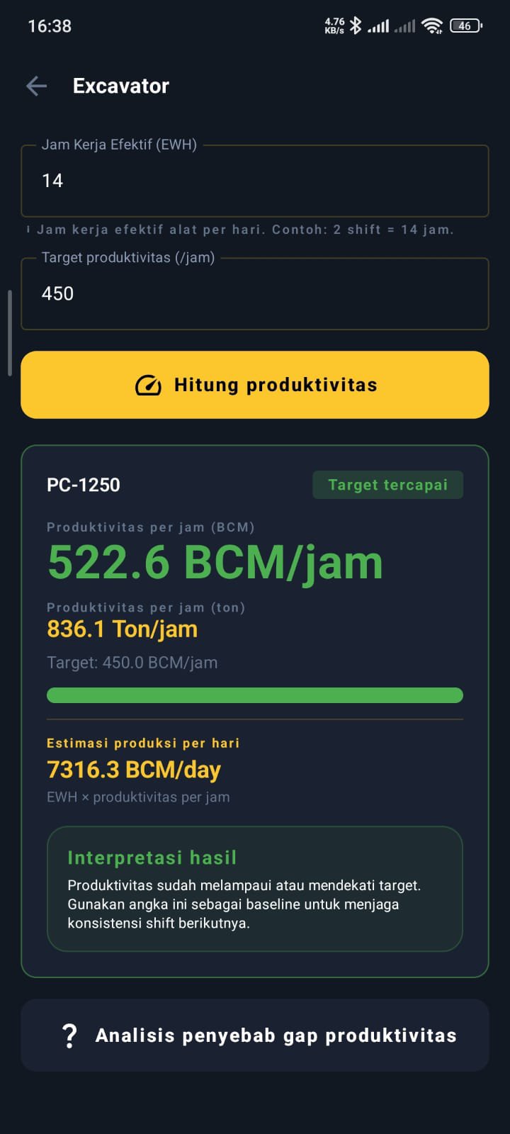
Equipment Performance Evaluation: Calculate Excavator, Hauler (Dump Truck), Dozing, and Ripping Productivity.
Fleet Optimization: Calculate Match Factor to align loading and hauling equipment to avoid queues or standby equipment.
💧 Field Hydrology & Utilities
Mine Water Management (Mine Dewatering): Calculate Water Runoff and Calculate Pump Discharge.
Built-in Sensor: Equipped with a Clinometer feature to conveniently measure slope or road slope angles.
Why Choose PITWISE?
This application is designed to solve real-world problems in physical work areas (coal mines, minerals, and civil/construction projects). Its intuitive interface ensures you can make operational decisions (Field Decisions) quickly and accurately.
Learn more and visit us at: pitwise.web.id
Latest Version
2.5.01Uploaded by
Harihar Yadav
Requires Android
Android 8.0+
Category
Free Productivity AppContent Rating
Everyone
Security Report
Check Now
Report
Flag as inappropriateLast updated on Apr 23, 2026
Peningkatan Presisi Visual Peta.
Transisi Sistem Koordinat (MGRS ke Hemisphere) seperti 48M menjadi format UTM Hemisphere (North/South) (contoh: 48S).
Optimalisasi Peningkatan akurasi pengambilan data mentah (raw data) dari satelit.
Perbaikan Isu Log In menangani kendala pada proses masuk akun (log in) untuk memastikan akses lebih lancar dan stabil.
APKPure - A multi-platform app store primarily focused on Android, providing extensive app-related content. Discover the app you want easier, faster, and safer, with quick and efficient downloads and installations.


