Use APKPure App
Get NaviCalc old version APK for Android
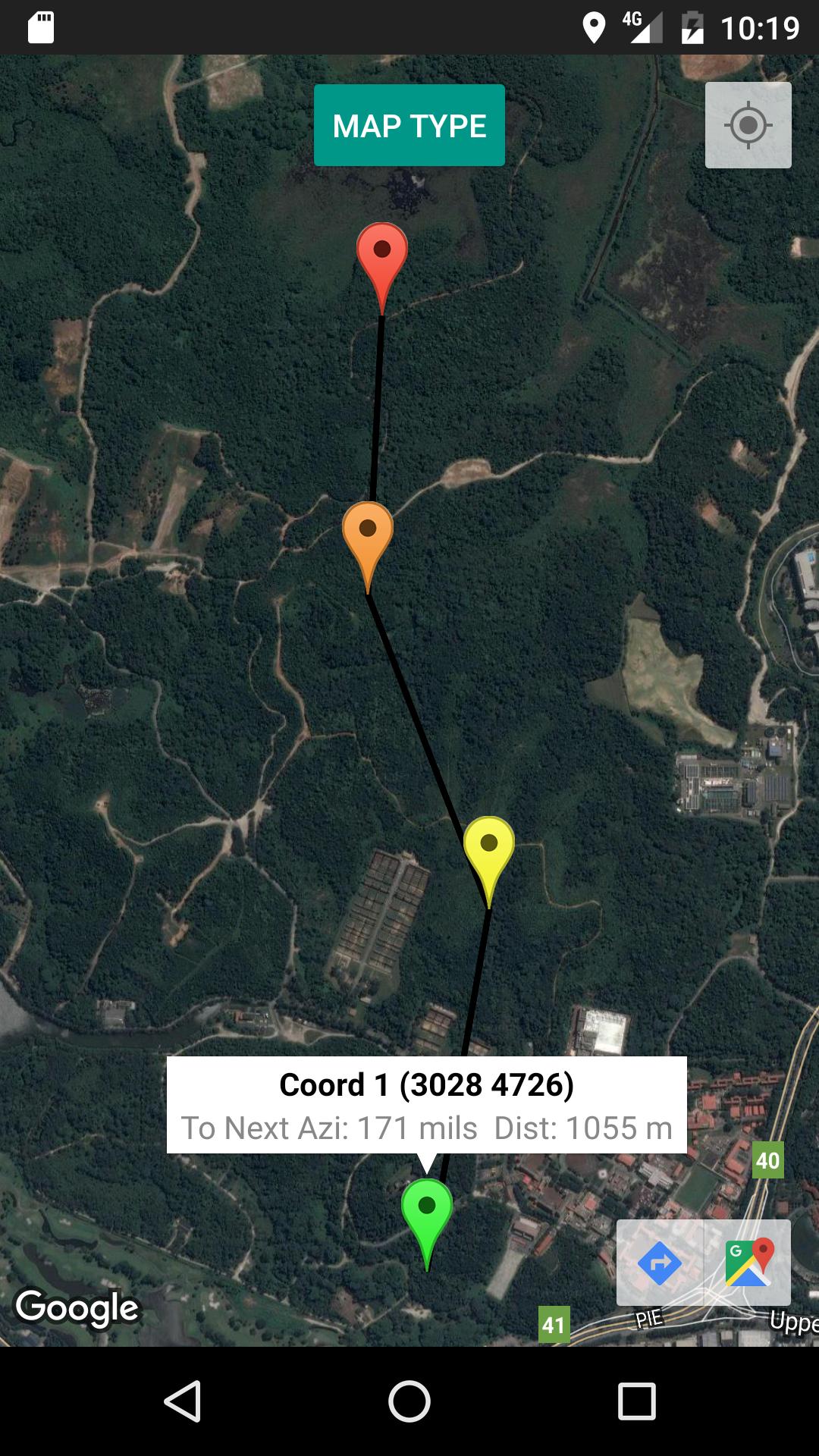
NaviCalc is a fast and simple way to calculate azimuth and distance for SG.
NaviCalc allows you to calculate the azimuth and distance by using the Military Grid Reference System (MGRS). Suitable for use in Singapore.
Features:
1) Azimuth and Distance Calculation
2) Plotting of Coordinates
3) Display MGR when you click on the map
4) Transfer MGR from map back to main page as Coordinates
5) Display Current Location and MGR
6) Saving and Loading of Coordinates
7) Calculate up to 4 Coordinates
8) Switch between 4 Map Types (Normal, Satellite, Terrain, Hybrid)
Last updated on Apr 21, 2017
8 coords can be now added up. (Originally only 4 coords)
Coords name can now be edited.
Information of the first coord will be displayed automatically.
The mils calculation and blue line between the coords is now removed from the map.
Latest Version
![]() 1.6
1.6
Uploaded by
Santino Schaumann
Requires Android
Android 4.0+
Category
Report


Discover what you want easier, faster and safer.

NaviCalc
1.6 by Seah Ying Hang
Apr 21, 2017