Package Name:com.codeensis.altimeter
SHA-256:d43a76c61ca5f485827bf41747a71cfb205bd273a9a41aae2caf735388e03360
Show More

Works offline - no signal needed. The altitude that matches the map, not the one your GPS chip guesses: for hiking, climbing, flying and cycling.
Your phone reports height above a mathematical ellipsoid, not above sea level. The gap between the two reaches 100 metres, and it is the reason so many altitude apps disagree with trail signs, survey markers and aviation charts. Altimeter corrects for it using the full EGM96 geoid model, then fuses the result with your barometer. The number you read is the number on the map.
Whether you're hiking, climbing, flying, cycling, road-tripping, or simply curious how high you are, Altimeter surfaces what matters - current altitude, GPS accuracy, coordinates, heading, and how your elevation is changing - in a clean, premium interface that reads like an instrument, not a cluttered outdoor app.
KEY FEATURES
True sea-level altitude
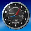
GPS, the EGM96 geoid correction and barometric pressure are fused into a single stable reading, with noise filtering that smooths out the jitter other apps leave in. View it as a clean analog dial or a big digital readout - your choice.
Live GPS details
See your altitude alongside GPS accuracy and coordinates, so you always know how good your current fix is. Tap to copy, and switch between decimal degrees, DMS, UTM and MGRS - the grid formats work fully offline.
True-north compass
A built-in compass with automatic magnetic-declination correction keeps you oriented on the trail and in unfamiliar places. It also measures the magnetic field around you and warns you when a car, a speaker or steel in a wall is pulling the needle off, instead of pointing confidently in the wrong direction. Choose a classic, marine or tactical dial, and read bearings in degrees, mils or gon.
Home screen widget
Your last altitude and a live countdown to the next golden hour, without opening the app. Every reading carries the time it was taken.
Elevation history and sessions
Your climbs are recorded automatically and charted over hours, days or weeks. Browse past sessions with peak, gain and duration at a glance.
Export your tracks
Export any session as GPX or CSV and open it in Google Earth, Strava, Garmin, a spreadsheet, or anywhere else.
Altitude alerts
Set one or more altitude thresholds and get notified when you cross them - useful for climbs, flights and target elevations.
Background tracking
Keep recording your elevation history even when the app is closed.
Make it yours
Premium themes, imperial or metric units, dial or digital display, and coordinate formats - tuned to how you work.
Sunrise, sunset and golden hour
Today's sunrise, sunset, day length and both the golden and blue hours - corrected for your altitude. Standing higher lowers your horizon, so the sun sets later than any sea-level table says: about 5 minutes at 1000 m and 9 at 3000 m. Pro can remind you before the evening golden hour.
Weather trend
On phones with a barometer, Altimeter watches how the pressure is moving and tells you whether the weather is holding, improving or turning, with a 3-hour chart. Every reading is reduced to sea level using your altitude, so climbing never looks like a storm.
ALTIMETER PRO
A single one-time unlock, no subscription. The only advertising is one small banner at the bottom of the History screen, and Pro removes it. If you want to try Pro first, one optional video unlocks it for 24 hours. Pro adds track export (GPX and CSV), extended history ranges, multiple altitude alerts, premium themes, photo overlays and background tracking. The core altimeter, compass and history stay free.
PRIVACY
Your tracks are stored on your device. Nothing is uploaded, sold or shared.
Download Altimeter: GPS and Compass and keep accurate altitude, navigation and elevation history in one elegant app.
Latest Version
1.4.30Uploaded by
Kamlesh Bhardwaj
Requires Android
Category
Free Maps & Navigation AppContent Rating
Everyone
Security Report
Check Now
Report
Flag as inappropriateLast updated on Oct 4, 2026
If your phone's location is switched off, Altimeter now says so on the main screen and stays there until it is fixed. The button opens the location switch itself, not the app's permission page, and readings start on their own once it is on. Before, a short notice faded after six seconds and the screen waited for GPS forever.



APKPure - A multi-platform app store primarily focused on Android, providing extensive app-related content. Discover the app you want easier, faster, and safer, with quick and efficient downloads and installations.