下載 APKPure App
可在安卓獲取Boating Maps & Fishing Points Charts的歷史版本
划船地圖和釣魚點圖表是最好的航海導航應用
Boating Maps & Fishing Points Charts is the best marine navigation for an android app with boating HD marine & lakes information of all the sea routes from all over the world includes sea world map. Marine navigation charts with GPS is a marine navigation light app that depends upon marine navigation technologies specifically design for boaters and sea lovers to find the best routes, hunts the biggest catch, and enjoys a sailing experience like never before with this marine navigation apps. With I boating marine and fishing maps get marine traffic boat ship vessel finder products includes fish finders, autopilot systems, transducers, action cameras, chart plotters, wind sensors, antennas and sensors, forward-looking scanners, sonar modules, and handheld and wearable devices along with map chart, marine electronics, marine radar and nautical chart to fully guide its user all over the complex routes.
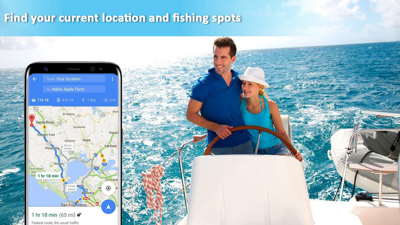
App for marine navigation with marine GPS give a location for coastal fishing or inland fishing, or you simply want to cruise and sail Boating Maps & Fishing Points Charts having GPS devices with boating marine & lakes information along Navionics boating marine and lakes can help you every point and plan your route accurately. Get this GPS navigation 2017 a GPS for marine predict weather conditions, sailing chart plotter, nautical chart plotter and stay connected with other networks and online platforms with marine navigation lights. Get this marine navigation chart plotting and marine navigation apps free and enjoy unlimited sea routes.
Boating Maps & Fishing Points Charts features:
Marine gps handheld
Boat gps with boat gps navigation
Boat navigation with boat navigation lights
GPS charter boat
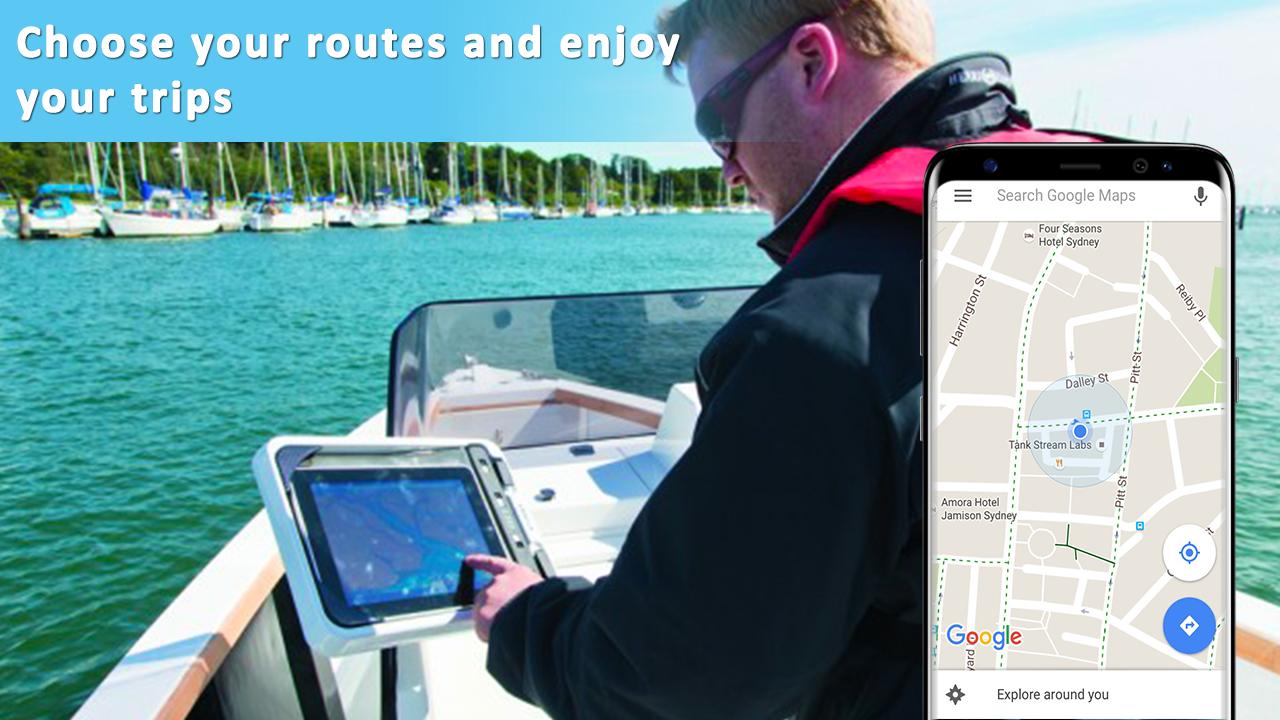
Marine navigation chart plotting
Waterways maps with boating maps
Waterway maps with i-boating &sea navigation
Nautical gps with fishing spots
Sea charts for marine navigation
Find fish navigation charts
GPS Boat Navigation
Mediterranean Sea GPS Nautical and Fishing Charts
Boating Maps & Fishing Points Charts having a fishing chart with GPS navigation system lake chart plotter provide high-end marine time navigation equipment that can be easily fixed on your boat with nautical map & weather cruise navigator. GPS navigation with navigation system devices is rich in user-friendly features. Free boating app a lake chart plotter can be customized to accommodate each user’s distinctive needs by map creation and compose diagram. The navigation with GPS technology for Bering Sea gold a boat navigation to provide exact and the most recent information for boating US & Canada HD and Norwegian cruise right when you need it.
Boating Maps & Fishing Points Charts a marine navigation and a navigation at sea scanner that can direct you to schools of fish and backtrack water columns GPS nautical marine navigation your boat has just passed by are shown in the map. Fishing GPS with sea charts having marine navigation charts provide autopilot system with GPS nautical charts and marine vessel tracker that automatically takes control when you need it. AIS ship tracking a shipping tracker with marine traffic ship position objective marine traffic to provide consumer-friendly navigational devices for use in water, air, or on land.
Last updated on 2018年07月21日
Minor bug fixes and improvements. Install or update to the newest version to check it out!


Boating Maps & Fishing Points Charts
1.1 by shahabapps
2018年07月21日