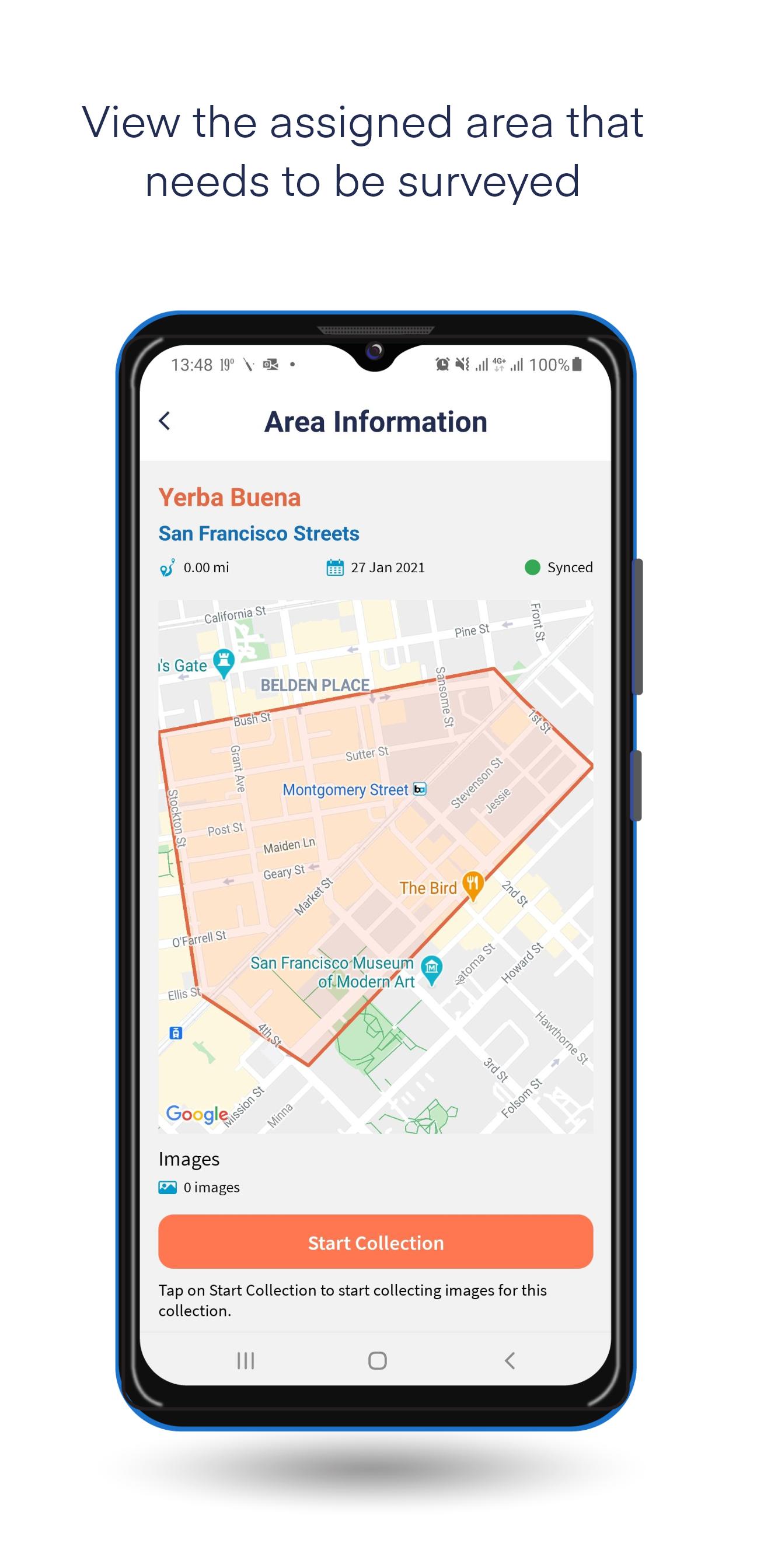
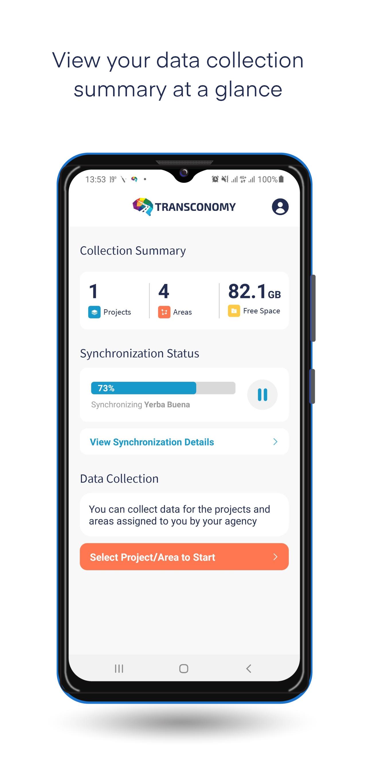
Transconomy lets state and local transportation agencies conveniently split network-level project data into manageable areas for image data collection.
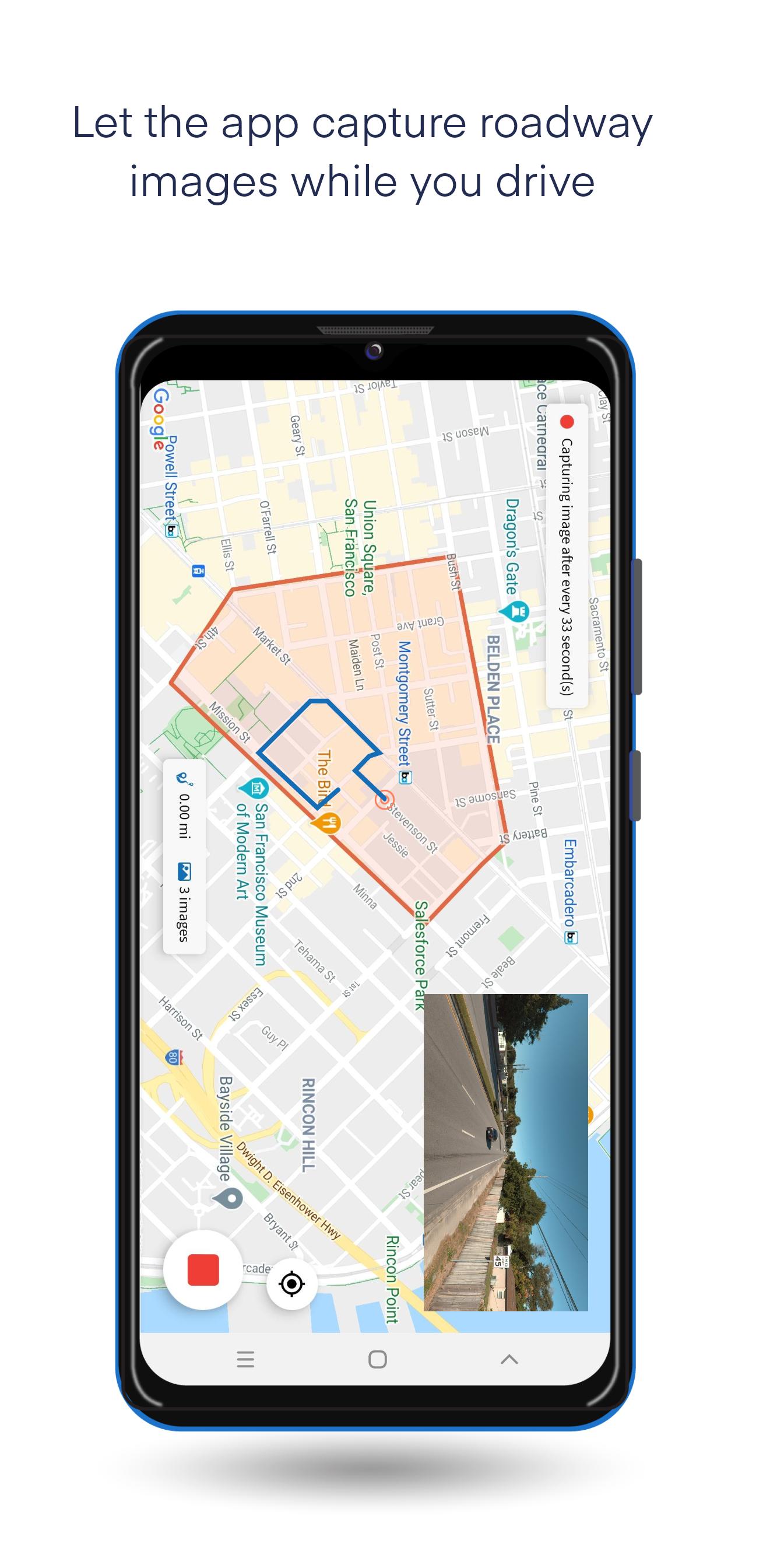
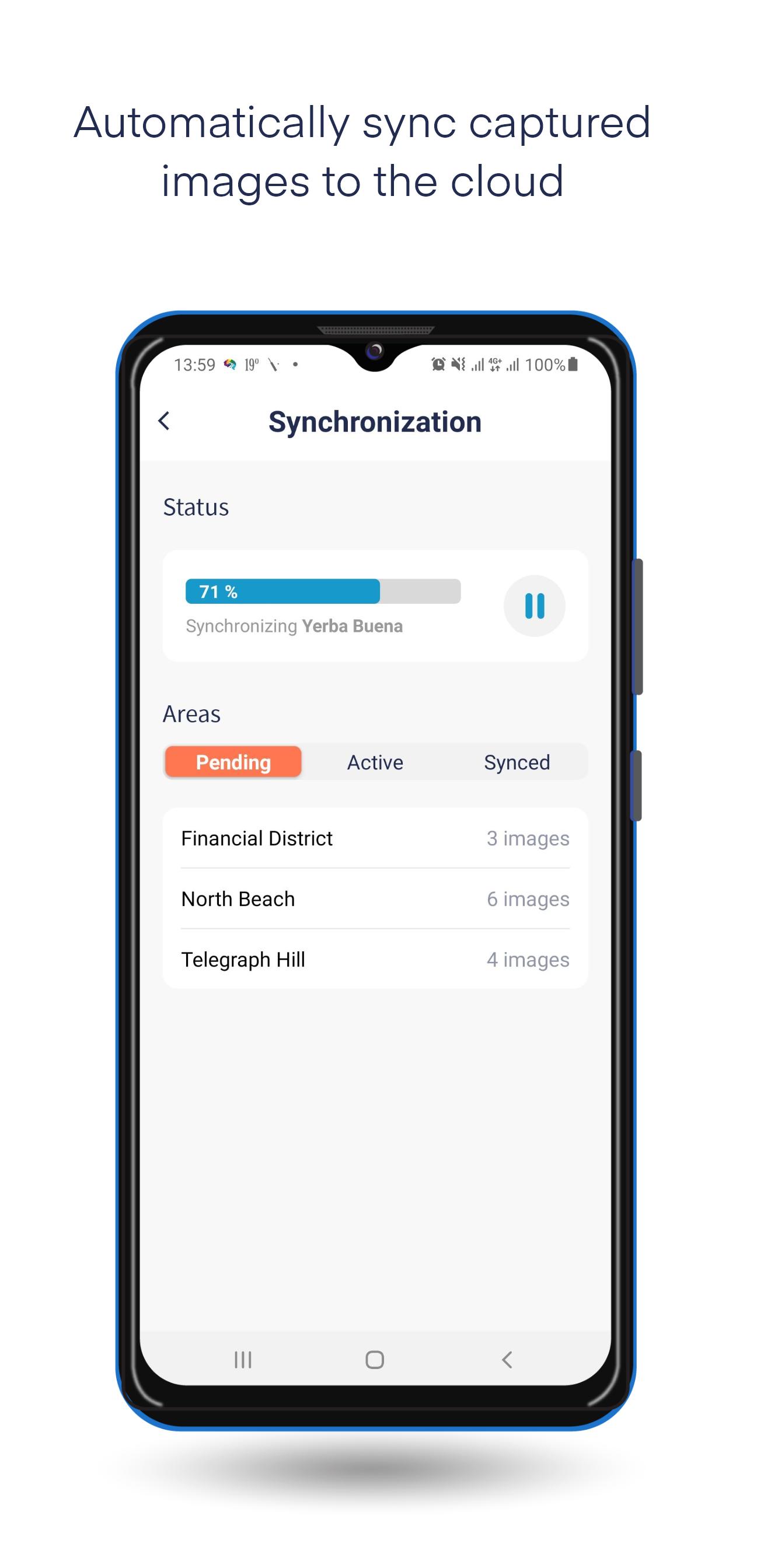
Allocate the areas to your collectors (data collection drivers) who can use the Transconomy Collector app to collect data in assigned areas. Specify a spatial or temporal frequency for image capturing. Your data collectors can use the app to visualize the areas assigned to them on a map for collection. While the collectors drive through the area, Transconomy Collector captures roadway images and uploads them directly to the cloud-based Transconomy Hub on the go. You can choose to use cellular data to sync as you drive or use a wireless network to sync after collection.
Latest Version
1.0.0Requires Android
4.1 and up
Category
Free Maps & Navigation AppContent Rating
Everyone
Report
Flag as inappropriateLast updated on Jan 27, 2021
Minor bug fixes and improvements. Install or update to the newest version to check it out!
APKPure - A multi-platform app store primarily focused on Android, providing extensive app-related content. Discover the app you want easier, faster, and safer, with quick and efficient downloads and installations.


