Use APKPure App
Get Wärtsilä iSailor old version APK for Android
Wärtsilä iSailor - Marine Navigation Chart Plotter
Wärtsilä iSailor is an easy-to-use navigational system developed for the amateur seafarers. Intended for use on boats and yachts, iSailor provides a clear presentation of navigation information and electronic charts. Transas own TX-97 vector chart format supported by iSailor is recognized worldwide as one of the most accurate and reliable sources of navigational information.
Available Chart Folios cover coastal and offshore waters of North America, Latin and South America, Europe, Africa, Middle East, Far East, Asia, Australia & New Zealand.
All chart folios can be selected, purchased and downloaded via the Wärtsilä iSailor app using its Chart Store section. Purchased chart folios includes a one year Chart Updates subscription service of your chosen coverage. At the end of one year you can choose to renew your Chart Updates subscription service or continue to use the charts you previously purchased and downloaded.
• Positioning system:
- Internal GPS (if available, through the Android Location Provider)
- NMEA GPS over Wi-Fi (TCP/UDP connection)
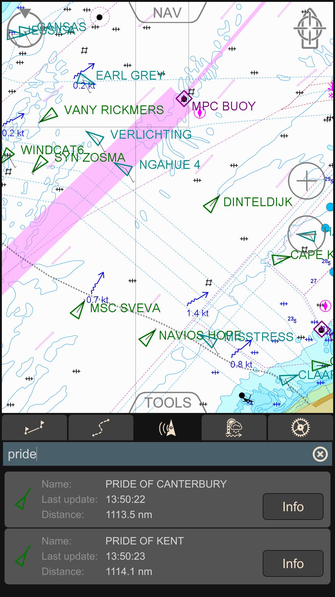
- AIS class B Transponder (TCP/UDP connection)
- Bluetooth NMEA GPS through the Android Location Provide ("Bluetooth GPS Provider" app is needed)
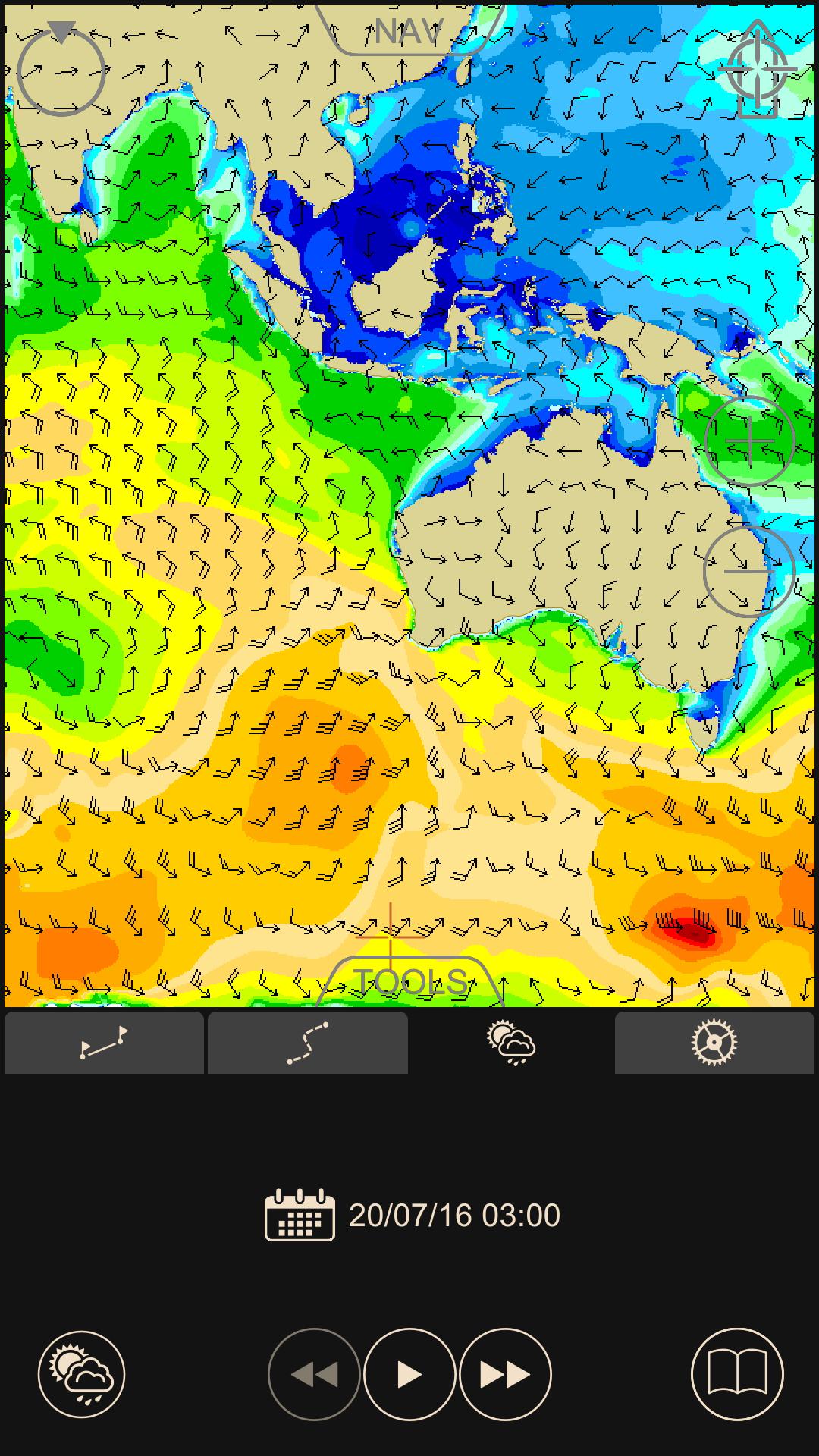
• Navigation sensors support: GPS, Compass & ROT (True or Magnetic Heading), Wind, Echo-Sounder
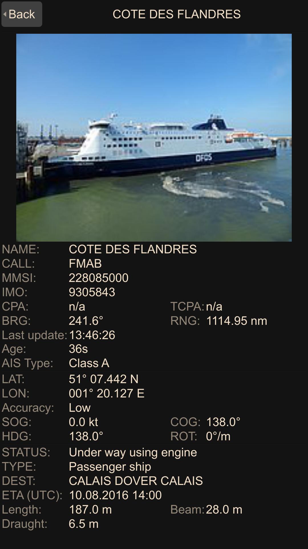
• AIS targets support: AIS Class A, AIS Class B, AIS Receiver, Base Stations, Aids-to-Navigation (AtoN)
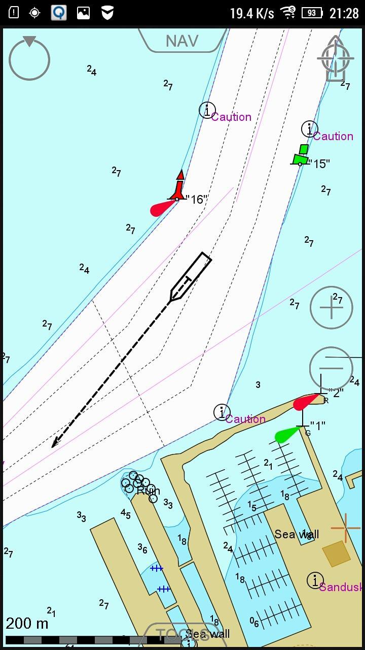
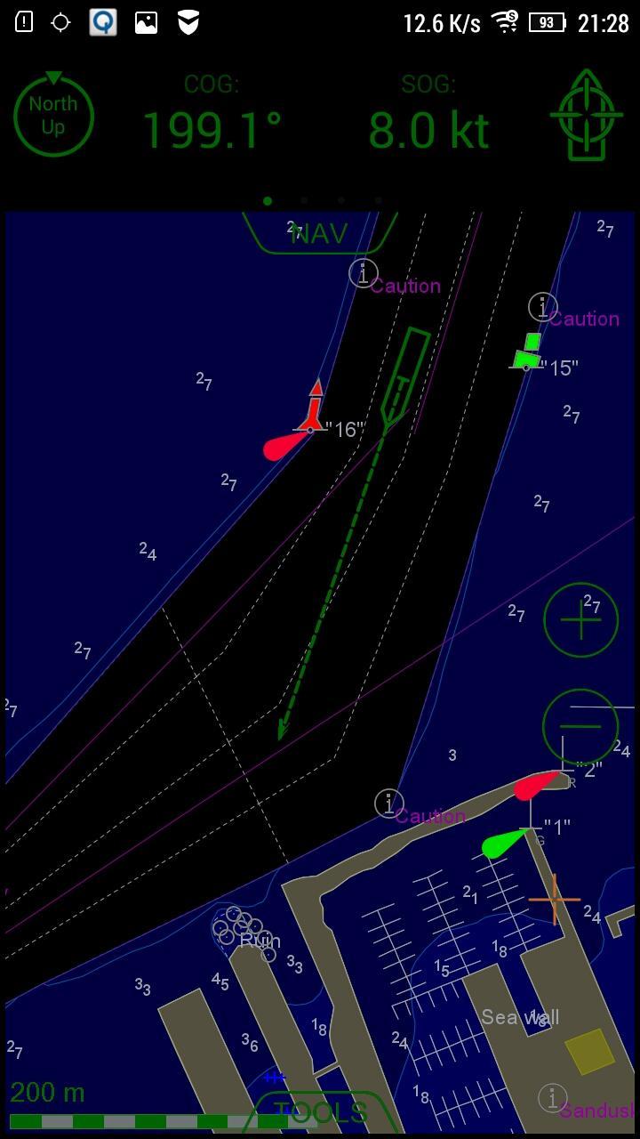
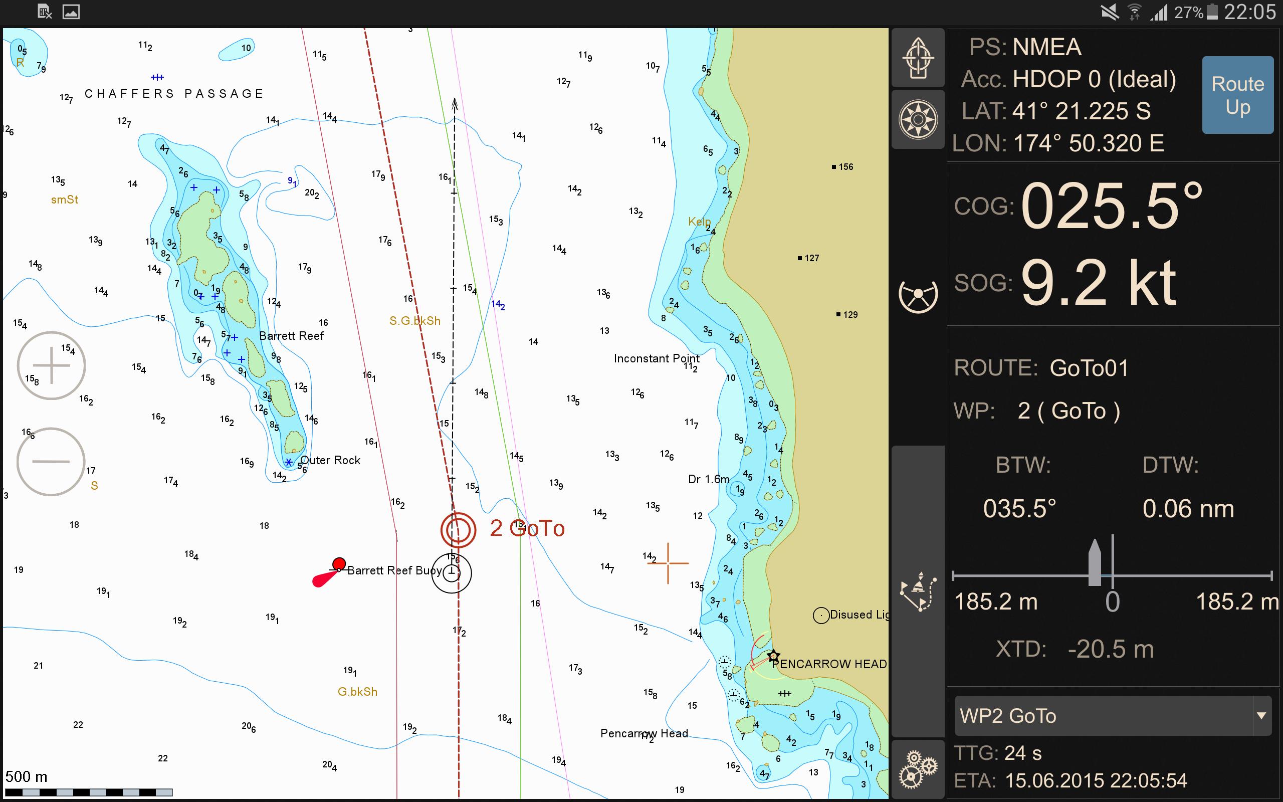
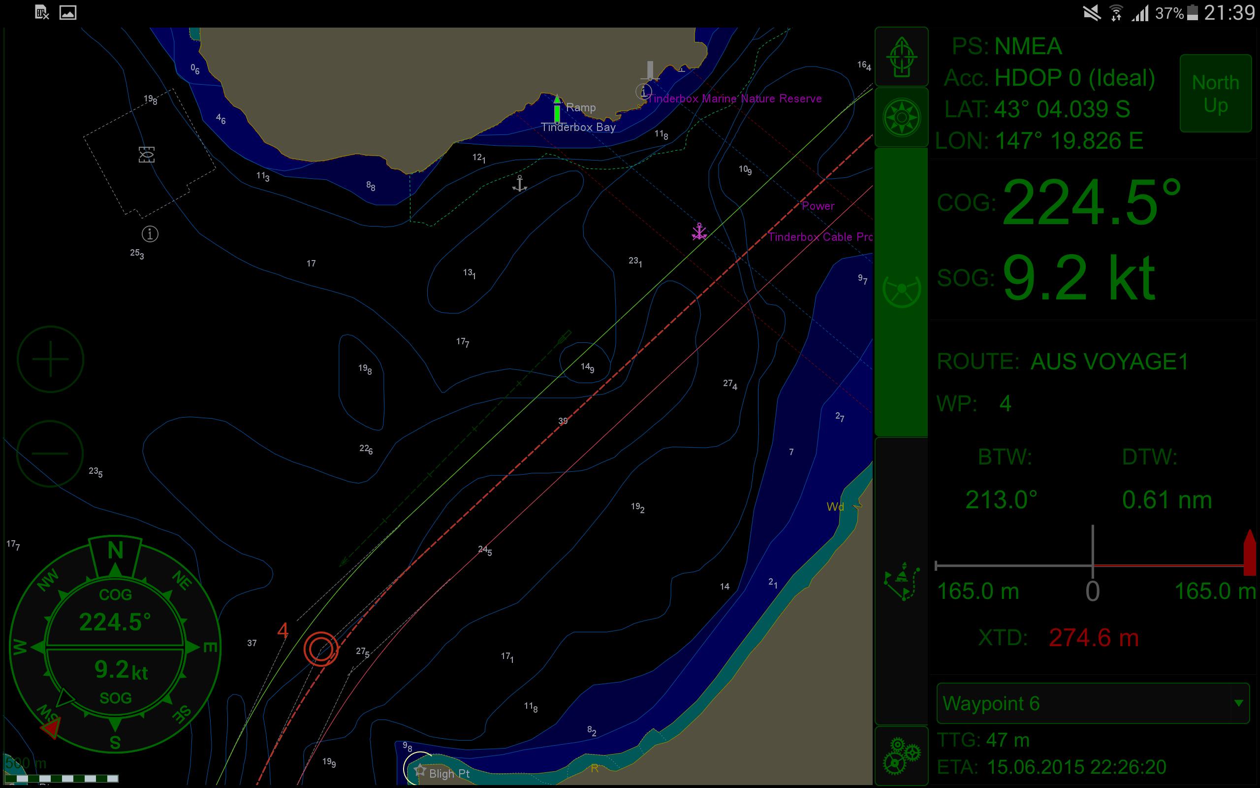
• Display of Charts and Routes
• North Up, COG Up and Route Up chart orientations
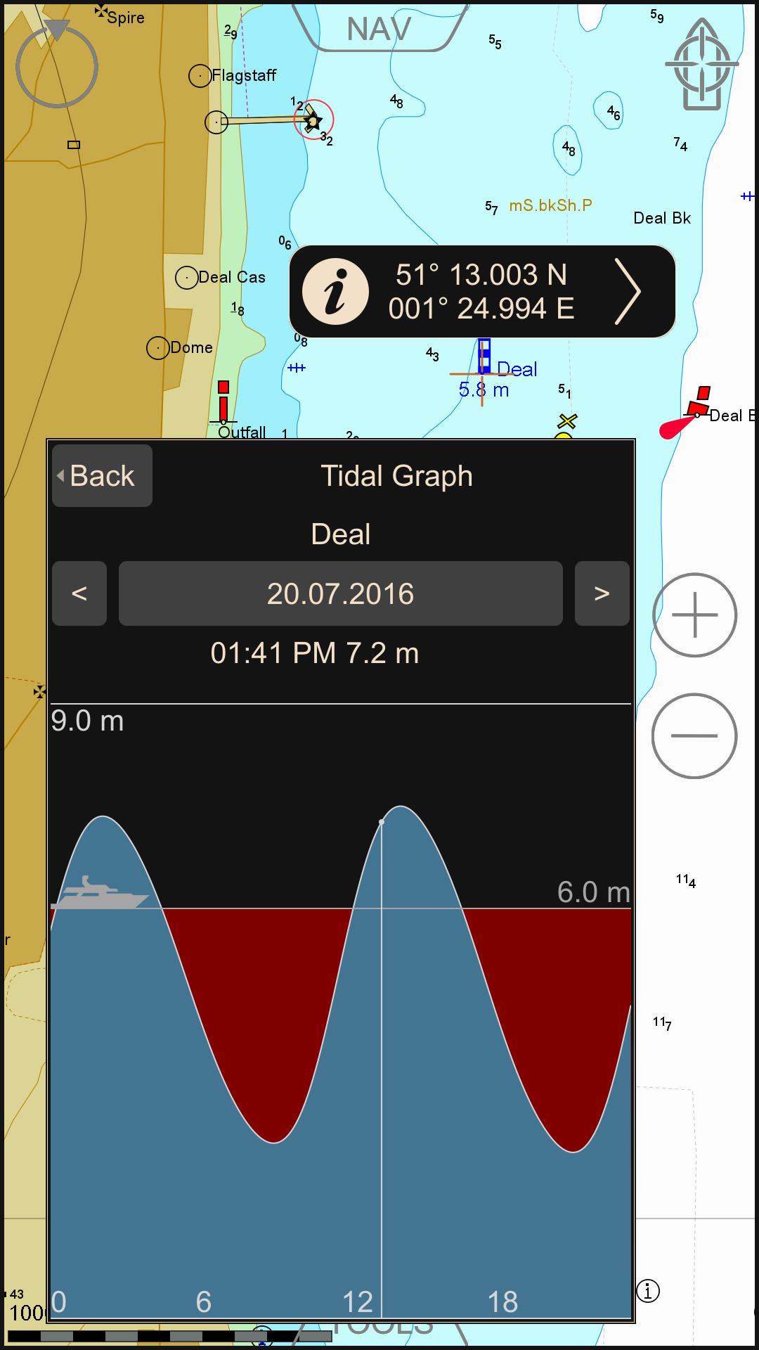
• Information on any vector chart objects
• Free cursor, Point-To-Point and Own Ship referenced ERBL functionality
• Monitoring of navigational data: Position, Course (COG) and Speed Over Ground (SOG)
• Route creation by the graphic methods. “Go To” routes
• Alarms & Warnings
• Waypoint monitoring: Bearing to WP, Distance to WP, XTD
• Schedule information: Time-To-Go and ETA to any selected waypoint ahead
• Day and Night chart palettes
• Track recording
• Import & Export for Tracks and Routes
• Multi-Units
Compatible with Android versions from 4.4.x (API level 19) up to Android 10 (API level 29).
Wärtsilä iSailor website http://www.isailor.us
If you have any questions, feel free to contact us at isailor.support@wartsila.com
Sincerely Yours,
iSailor team
Last updated on Jul 16, 2020
* Compatibility with OS Android 10.0
* Bug fixing
Sincerely Yours,
Wärtsilä iSailor team
En Son Sürüm
![]() 2.81
2.81
Yükleyen
Andi Rifky Rifky
Gereken Android sürümü
Android 4.4+
Bildir
Discover what you want easier, faster and safer.

Wärtsilä iSailor
2.81 by Wärtsilä Voyage Limited
Jul 16, 2020