Use APKPure App
Get GeoFlyer Europe 3D - Offline Maps GPS Routing old version APK for Android
3D-kaarten, Trails, GPS tracking, Augmented Reality voor Hike Bike en Outdoor
How would you like a mapping app with routing and GPS tracking that offers you the BEST 3D VISUALIZATION for the outdoors?
How would you like a mapping app that shows points of interest in 3D with info or links to embedded Wikipedia pages?
GeoFlyer Europe 3D offers you all this and more!
The app is provided as a free Lite version, then a subscription or a permanent license purchase is available.
If you love hiking, biking, horseback riding, or any other outdoor activity, GeoFlyer 3D Maps is the app you need.
MAIN FEATURES
- Online and Offline modes (with preloading of selected areas)
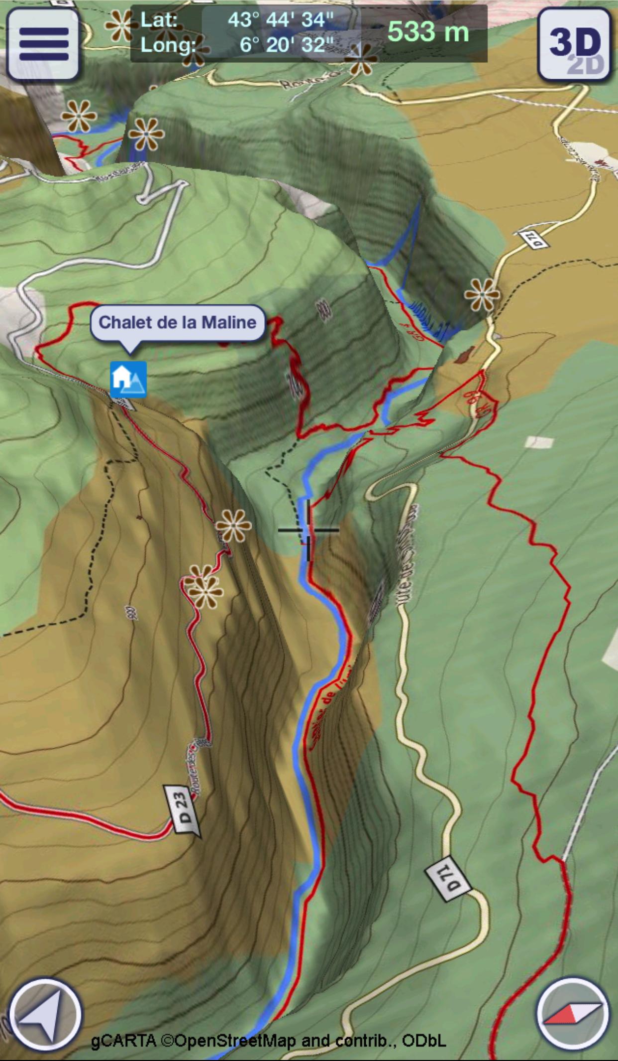
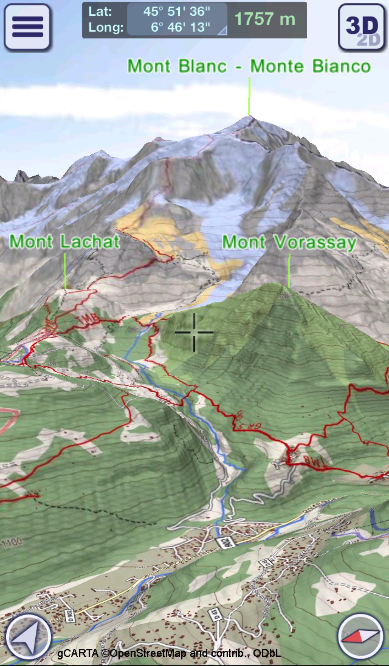
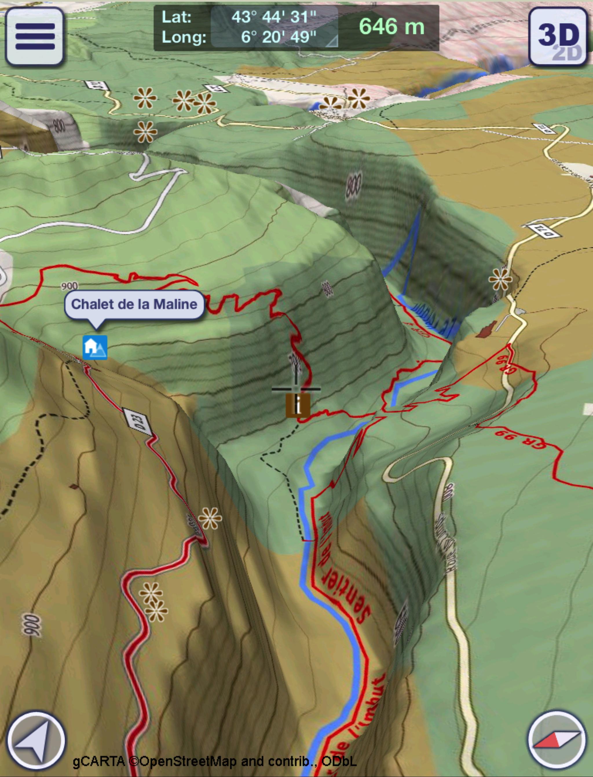
- Highly-detailed 3D terrain
- 3D labels/icons of Points of Interest (POIs)
- Integrated Wikipedia descriptions
- Place searching by name (Online and Offline)
- GPS tracking
- Routing
- Personal Points of Interest (POIs)
- Import, export and share of tracks and routes with your friends and among your devices
- Altimetry graph and statistics
- Custom-made gCARTA topographic chart
- Augmented Reality Module
- Gyroscope features: GyroPilot
GeoFlyer Europe 3D reproduces the terrain in 3D with stunning details, using the best available digital elevation models from NASA and various European mapping agencies.
The terrain is overlaid with a custom-made topographic chart (gCARTA) that shows trails and accurate elevation contour lines, or aerial images if you prefer.
Find out more about a POI using the labels and icons. Wikipedia geo-tagged entries and other associated content are integrated right into the 3D map.
Plan your trip using multiple routing options, and save your routes for later use.
Record your GPS tracks and share them with your friends through Facebook or other social media.
Get the best from your outdoor experience with the “Augmented Reality” module, that enables to discover many details about the environment around you, thanks to the overlapping of points of interest and geographic names on the image taken by the camera.
And it’s fun! Try the GyroPilot mode: dive into the valleys with a low level flyby, handling your device like a virtual plane, and explore the maps like a top-gun pilot!
GeoFlyer Europe 3D… your outdoor companion!
WARNING
Continued use of GPS running in the background can dramatically decrease battery life.
Last updated on May 27, 2018
- Fixed a bug about label visibility.
- Fixed other minor bugs.
Laatste Versie
![]() 2.2.1
2.2.1
Geüpload door
Lovely Amma
Android vereist
Android 4.2+
Categorie
Melden


Discover what you want easier, faster and safer.

GeoFlyer Europe 3D - Offline Maps GPS Routing
2.2.1 by GeoMind
May 27, 2018