Identify and label peaks, mountains and hills in
your live camera preview or in photos accessible from your device.
See
http://www.peakidentify.com/Help
for full help on usage and features.
Identify peaks in your camera's live view
PeakIdentify has a database of over 340,000
mountains, peaks and volcanoes from all over the
world. In addition to peak name, the labels also
show the height and distance of each peak from you.
Identify peaks in photos
PeakIdentify lets you view any photo accessible
from your phone or tablet and identifies and labels
the peaks in the photo.
Save labeled photos
PeakIdentify lets you take and save a snapshot
of your live preview. You can also save a
peak-labeled copy of your snapshot or of
an old photo.
3D elevation terrain
PeakIdentify optionally superimposes a 3D
model of the view around you. The terrain model
can be used to better align the labels with your
live view in case of poor compass calibration and
is essential for identifying the correct direction
in your photos.
Digital elevation maps for most of the world are
available and will be downloaded automatically
for your current location.
You can also download elevation maps for a
planned hike or photo-shoot, by providing a
location on the Google maps screen.
Google maps view
PeakIdentify shows your current location, or that
of your photo, on Google maps.
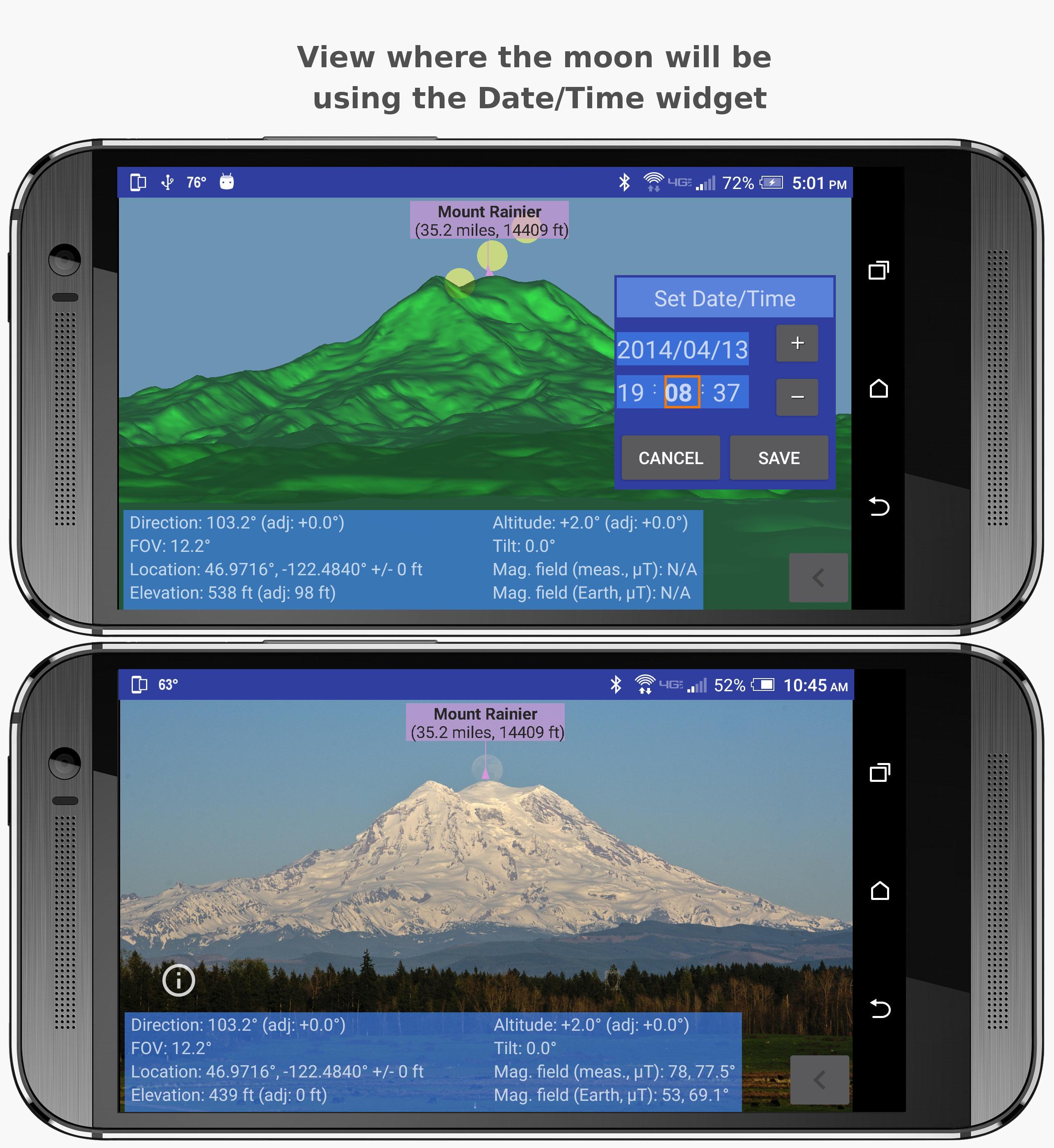
Sun and Moon orbits
PeakIdentify provides a great tool for
photographers planning to take pictures of the
moonset or moonrise above a particular
mountain or peak.
It shows the direction of the moon and the sun,
relative to the current position, on the Google
maps screen.
It also superimposes the moon and the sun in
your live or photo view.
You can adjust the date and time so you can tell
exactly where the moon will be.
Versi Terbaru
Varies with deviceMemerlukan Android
6.0
Category
Fotografi APLIKASIPenilaian Kandungan
Everyone
Laporkan
Tandai sebagai tidak sesuaiLast updated on Jul 25, 2019
Minor bug fixes and improvements. Install or update to the newest version to check it out!


APKPure - Sebuah gedung aplikasi berbilang platform yang tertumpu terutamanya pada Android, menyediakan kandungan berkaitan aplikasi yang meluas. Temui aplikasi yang anda mahukan dengan lebih mudah, pantas, dan selamat, dengan muat turun dan pemasangan yang cepat dan cekap.