Maps3D is for Hikers.
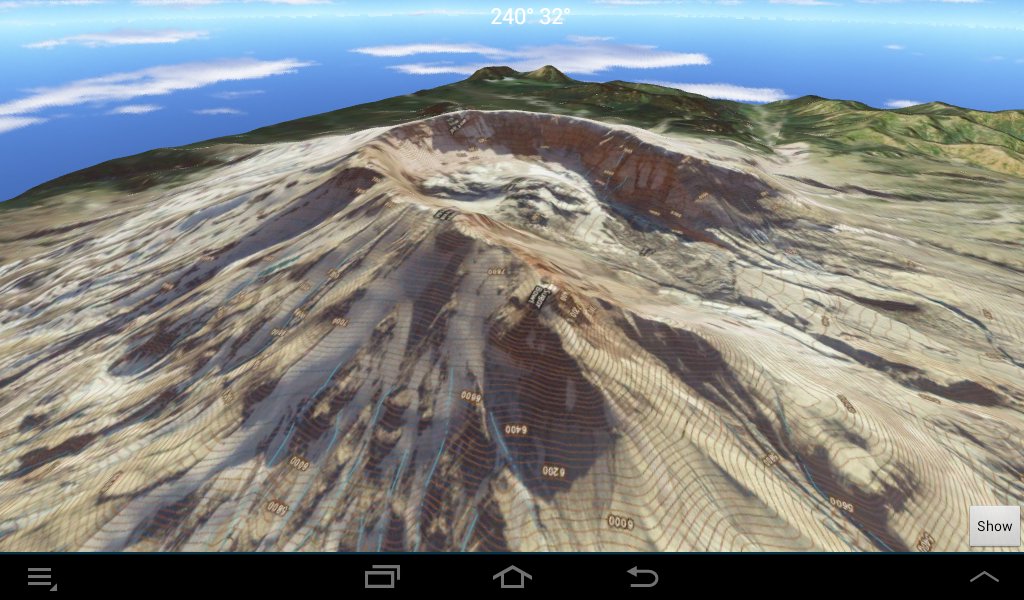
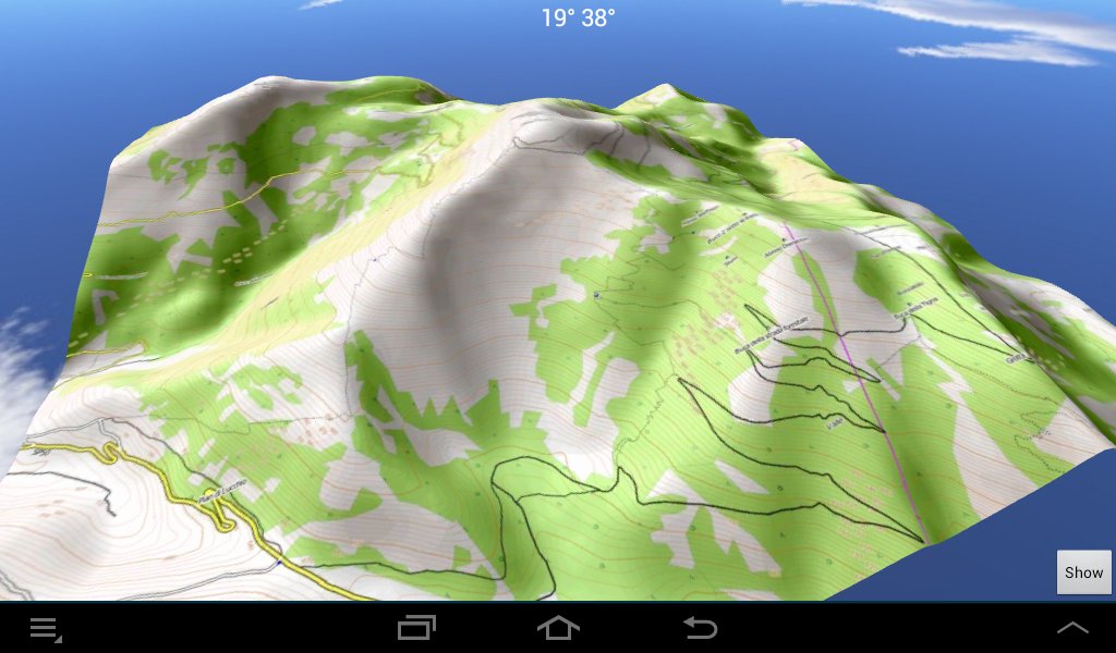
It creates high quality 3D Maps using OpenStreetMap, Usgs and Agea, which can be used offline with Gps.
Maps3D implements many useful features for Hiking:
• Create 3D maps for OpenStreetMap, Usgs, Agea
• Use Internal Gps or external Bluetooth Gps
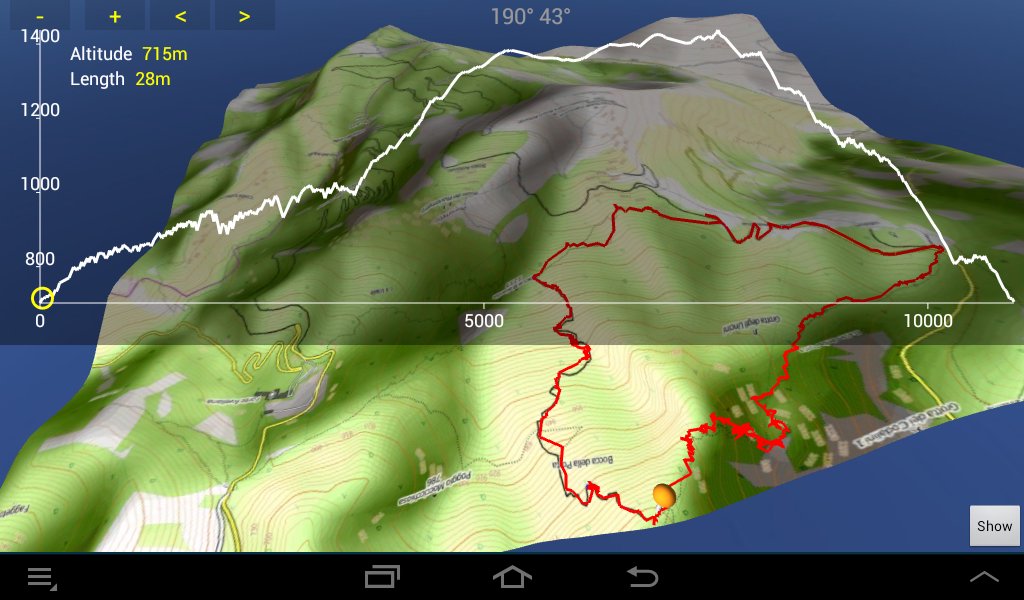
• Record the Gps track
• Load gpx tracks from memory card
• Search and download gpx tracks everytrail.com
• Upload the Gps track to everytrail.com
• Show the altitude profile of the tracks
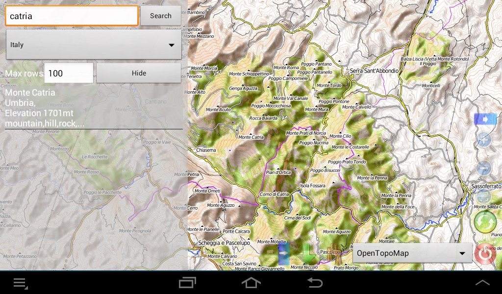
• Search and show on the map toponims from geonames.org
• Record waypoint with notes and photo
• Use the digital Compass to position the map
• and others...
Latest Version
2.0.8Uploaded by
Kool Samui
Requires Android
Android 2.3.4+
Category
Free Entertainment AppContent Rating
Everyone
Report
Flag as inappropriateLast updated on Feb 3, 2016
+ fixed. The display of a track profile could freeze the app.
+ fixed. The download of everytrail trails could fail with an XML parse error.
APKPure - A multi-platform app store primarily focused on Android, providing extensive app-related content. Discover the app you want easier, faster, and safer, with quick and efficient downloads and installations.


