
LandStar helps surveyors and mapping crews handle daily jobs that demand precise positions and clear workflows. It organizes common tasks so you can plan, collect, and stake out points with fewer steps. The interface stays simple to read in the field, and data moves easily between projects. If your team works across different devices, LandStar APK runs on compatible Android phones and handheld controllers. It suits new users and experienced teams alike, since settings adapt to different job types.
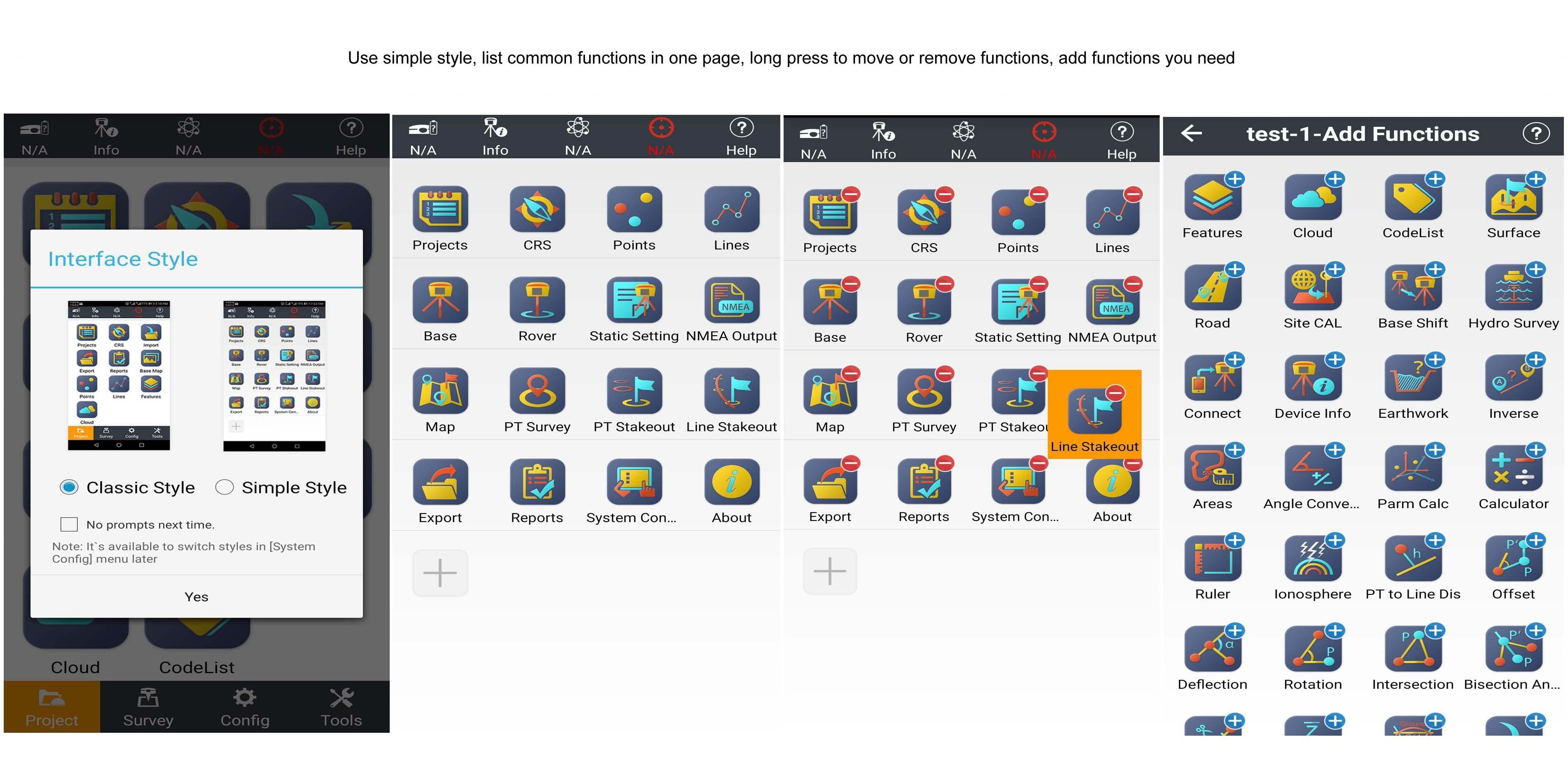
Two interface styles
After you download LandStar, you can switch between Simple and Classic styles with one button. Simple shows essentials on one screen for quick checks. Classic groups tools by workflow for wider control. This helps new users start fast, while experienced users keep everything organized.
Work modes and measurements
Next, LandStar lets you preset base and rover modes and change them with a tap. You can work in RTK, static, or stop and go. Point collection offers several methods for topographic, control, quick, continuous, offset, EBubble compensated, and corner points.
Data formats and base maps
For data handling, LandStar supports common formats and maps.
Stakeout and devices
Finally, you can stake out with map mode to see current and target positions, or use compass mode for direction. Reference by North, Sun, or a point. Stake out points, lines, and surfaces from supported files. LandStar also connects to laser rangefinders, pipeline locators, and echo sounders when needed.
LandStar focuses on practical field work from setup to data handover. It supports precise measurement, clear stakeout, and common formats used on site. Check the LandStar latest version for recent stability and format updates. Install on a compatible Android device and start your next job with familiar tools.
Latest Version
7.3.5.1.20210526Uploaded by
Muhammad Zulfano
Requires Android
Android 4.2+
Category
Free Maps & Navigation AppContent Rating
Everyone
Report
Flag as inappropriateLast updated on May 31, 2021
1.Add Dutch local coordinates,support GTX geoid file.
2.Support GDM export.
3.Support GNSS reciever i73.
4.Support dual-frequency depth sounder Hydrolite DFX.
5.Optimize the function of road stakeout.
6.Optimize SD card read & write.
7.Optimize the surface fitting method.
8.Fixed some other known bugs.


APKPure - A multi-platform app store primarily focused on Android, providing extensive app-related content. Discover the app you want easier, faster, and safer, with quick and efficient downloads and installations.


