Site Scan™ for the Solo® smart drone is a complete camera-to-cloud aerial analytics system that makes it safer, faster and easier than ever to aggregate and process aerial data and perform inspections. (Software license and full hardware packages available on 3dr.com)
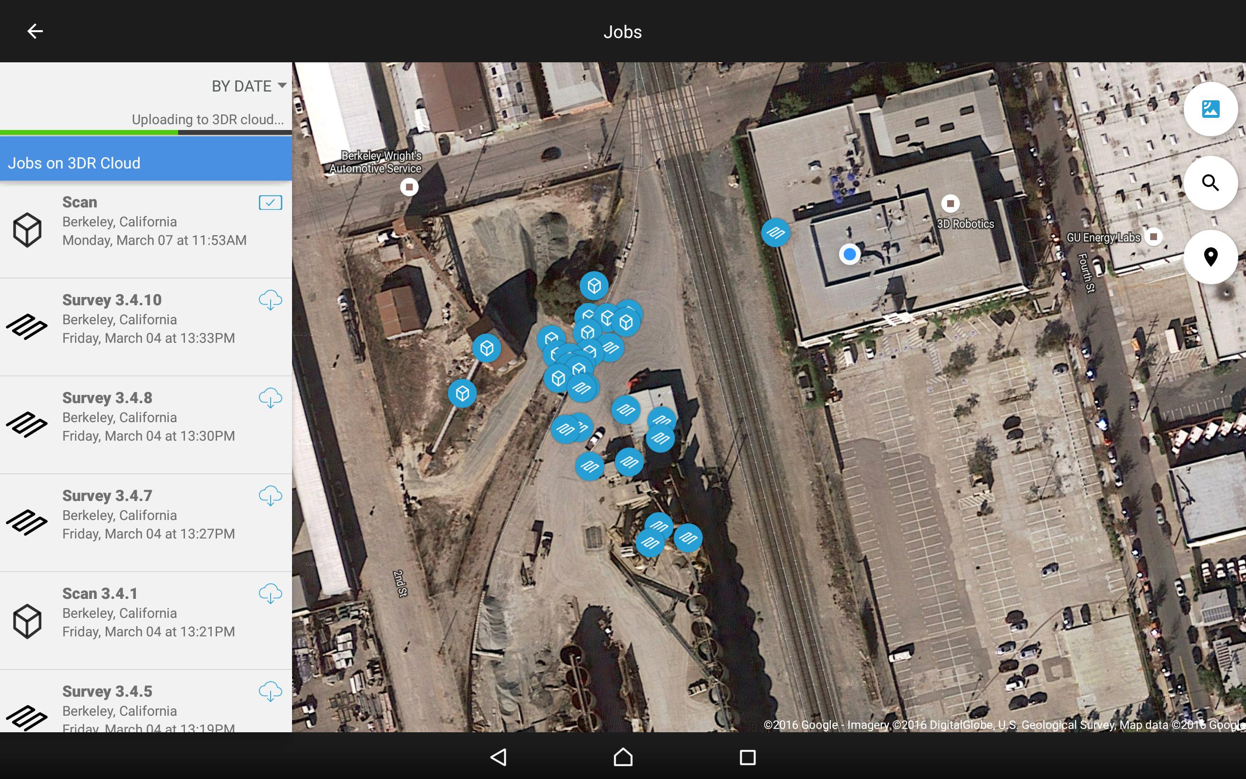
Site Scan automatically plans and executes both flight and high-resolution reality capture for conducting site surveys and scans. Securely upload that geotagged data to the 3DR cloud and Autodesk® ReCap for automatic processing into orthorectified 2D maps, DEMs, 3D point clouds and 3D mesh. Once processed, you can seamlessly port this data to your cloud analytics systems, including full integration with the Autodesk program suite.
Additionally, Site Scan enables you to inspect, examine and photograph towers and other structures with everyday swiping and pinching on the tablet screen, leveraging the Sony® camera’s zoom lens (available June) where precise imagery is required to capture asset identification information.
The three Site Scan modes:
Survey.
Simply outline the area you want to survey with your fingertip and Solo automatically plans and executes both flight and image capture, gathering all the data you need to create 2D maps and DEMs. Images are processed in Autodesk ReCap to create orthorectified, georeferenced mosaics.
Scan.
Tap your finger and Solo lifts off and circles your site or object of interest, capturing all the imagery ReCap needs to generate a photorealistic georeferenced 3D model. Processed imagery is available immediately in your A360 account and securely saved in the cloud.
Inspect.
Safely and easily inspect critical infrastructure and elevated objects like rooftops, towers, and powerlines. Images are automatically paired with rich metadata and uploaded to the 3DR cloud for review and sharing. Control the camera and vehicle with familiar tablet gestures, allowing any field service technician access to the sky.
Monitor your worksite as it evolves: Light up Autodesk 360, Revit, BIM360 and Civil3D with precise 3D scans of your job site. Deploy resources more efficiently and monitor the progress of your worksite over shorter time intervals.
Collaborate in the cloud: Autodesk 360 project collaboration software helps design, engineering and project teams work together efficiently on a centralized platform. View, search and share data using desktop, web and mobile devices.
Last updated on Oct 11, 2016
During Scan mode, flight speed has been optimized to allow for a higher quality data product. In some cases, the Solo might fly slower to collect more photos.
3DR Cloud exporting enhancements - you can now share an entire job via a single .zip file right from the app
3DR Cloud upload improvements
Indication when Survey path selected that would result in capture of more than 250 images
Improved messaging and notifications throughout the system
Improvements to firmware update discovery




APKPure - 안드로이드를 중심으로 한 멀티플랫폼 앱스토어로, 다양한 앱 관련 콘텐츠를 제공합니다. 더 쉽고, 빠르고, 안전하게 원하는 앱을 찾아보세요. 빠르고 효율적인 다운로드와 설치가 가능합니다.