APKPure Appを使用する
Martley Rocksの旧いバージョンをダウンロードすることが可能
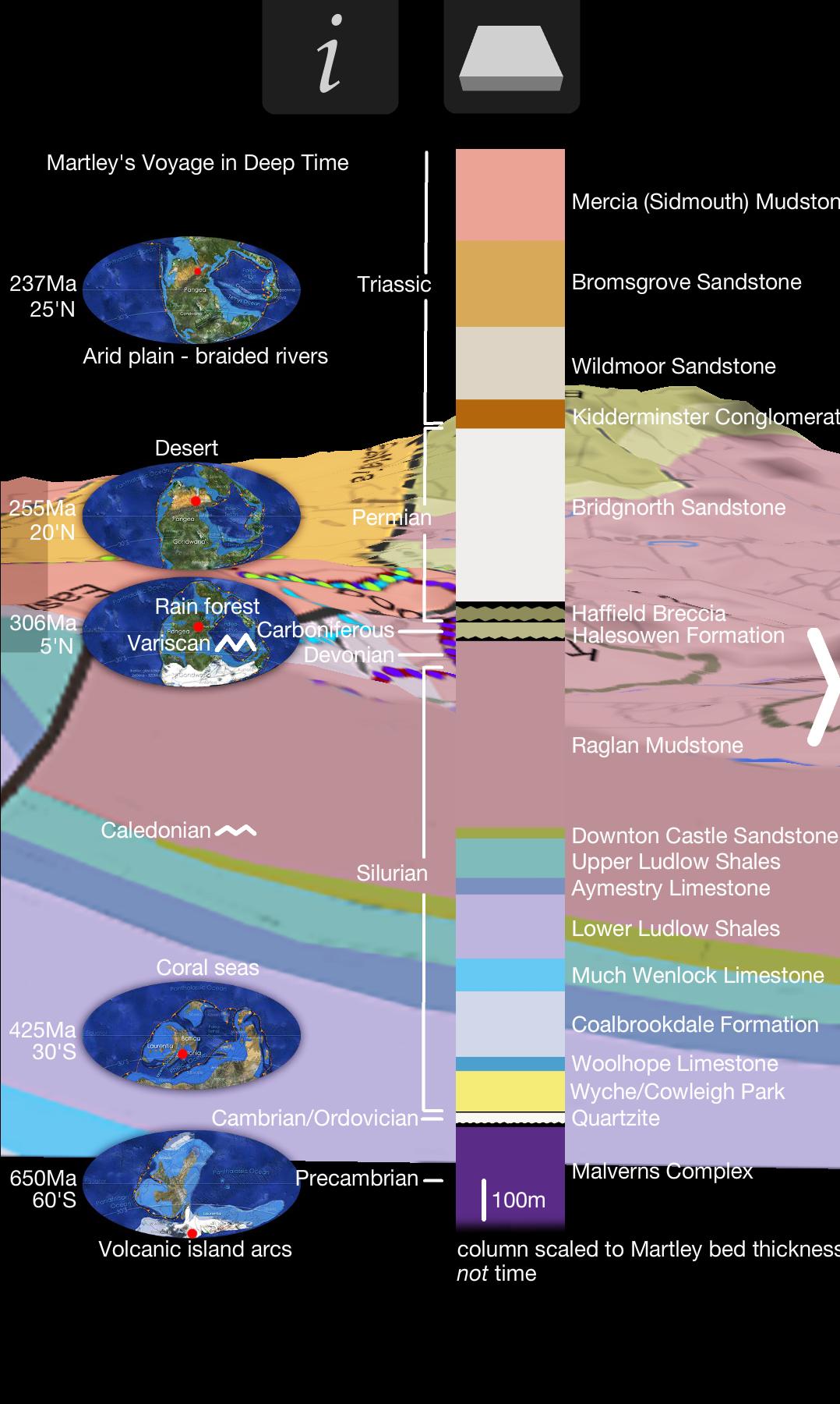
Martley地質のインタラクティブな3Dモデル。
Interact with the fascinating and exceptional geology of Martley, Worcestershire, England, with this app which provides an interactive 3D model of the area. View the terrain by moving around the model with touch gestures or tilting your device.
Interpretation of past environments and the ‘Voyage of Martley’ from the near the South Pole to 52’N over 700 million years of Earth history.
Touching the map provides information about the geology of your location.
Includes the routes for all Martley GeoTrails plus the Geopark Way, with of course GPS guidance of your current position on the path.
Special section for Martley Rocks site, which includes interactive map based on latest trenching work, with photos ‘from the trenches’ and interpretation along the entire length of the permanent trench.
2D map of geology and trails from Abberley to The Talbot, with photo hot spots and cross-section.
Sections for the Chantry School Rock Garden, The Nubbins, Worcestershire Basin, GeoVillage & TVGS and ‘Where is Martley’.
Last updated on 2021年12月22日
Large scale map of paths and geo-trails in the Martley area and beyond.
Update for latest devices.
最終のバージョン
![]() 3.0.1
3.0.1
投稿者
الامل العطور
Android 要件
Android 5.0+
Available on
![]()
カテゴリー
報告


Discover what you want easier, faster and safer.

Martley Rocks
3.0.1 by BrooksDesigns
2021年12月22日