Scan Date:May 2, 2026
Show More
Coordinate Plot – Automatic Professional Survey Plan Plotting and parcelation engine.
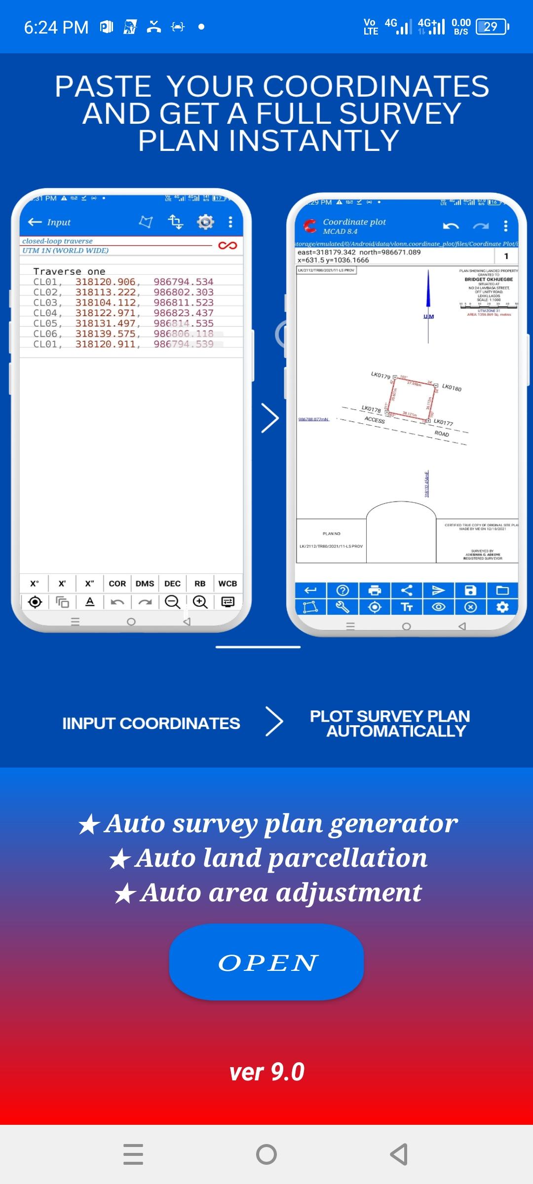
Coordinate Plot is a professional surveying application designed to automatically generate complete survey plans from accurately entered field coordinate data. It is built for practicing surveyors, drafting professionals, firms, and surveying institutions who require reliable tools for real-world surveying and land-drafting work.
This application supports standard surveying workflows, enabling professionals to move efficiently from field data to a fully plotted survey plan while reducing manual drafting time and minimizing errors.
It is designed to reduce manual plotting errors, eliminate repetitive calculations, and help surveyors work faster with confidence.
Coordinate Plot is not a casual or experimental app. It is intended for professionals working on active projects who depend on accuracy, consistency, and dependable output.
CORE PURPOSE
Coordinate Plot focuses on the following core professional tasks, all driven by surveyor-entered data and professional judgment:
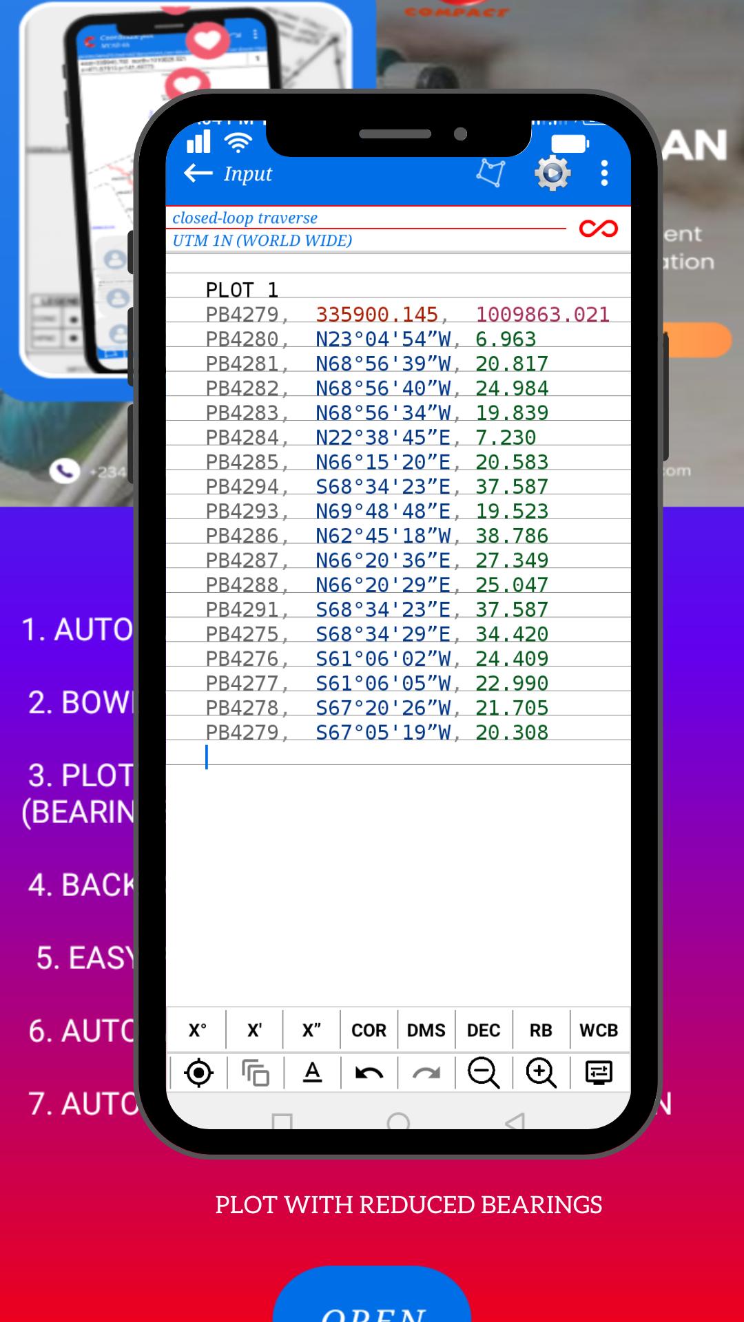
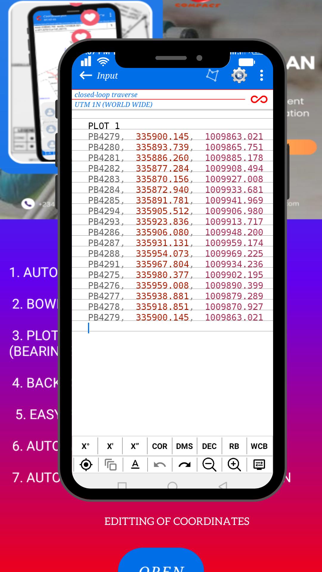
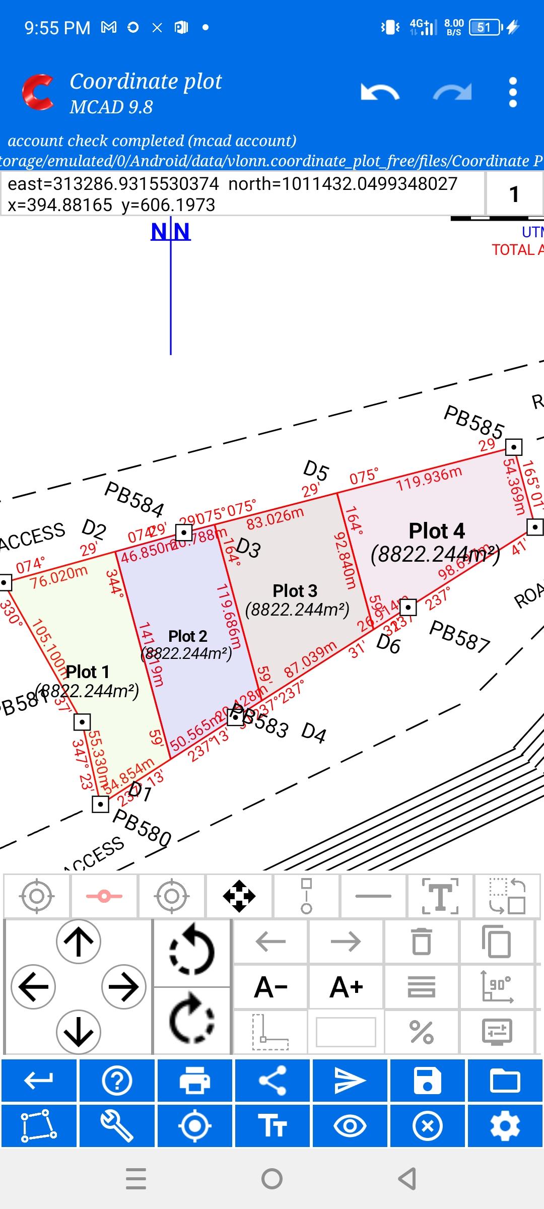
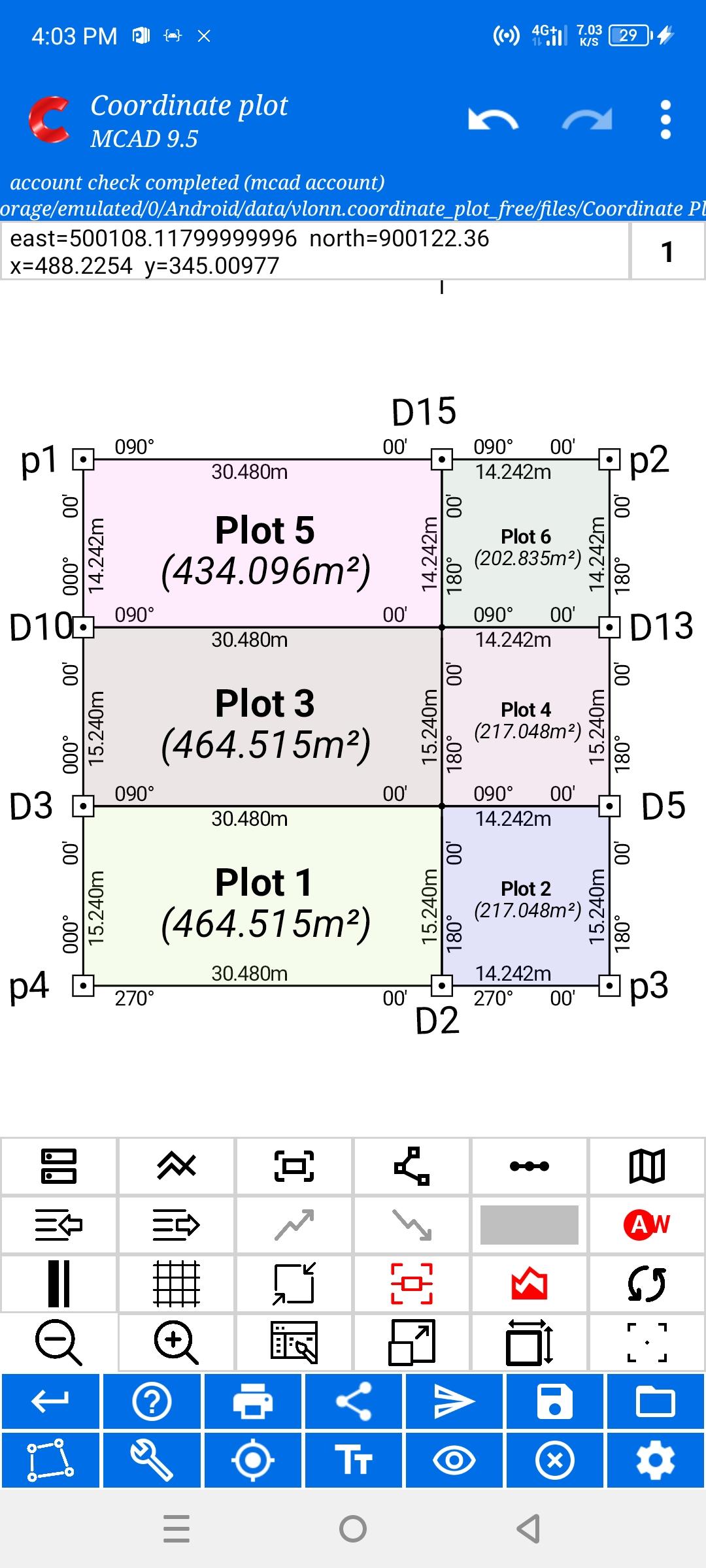
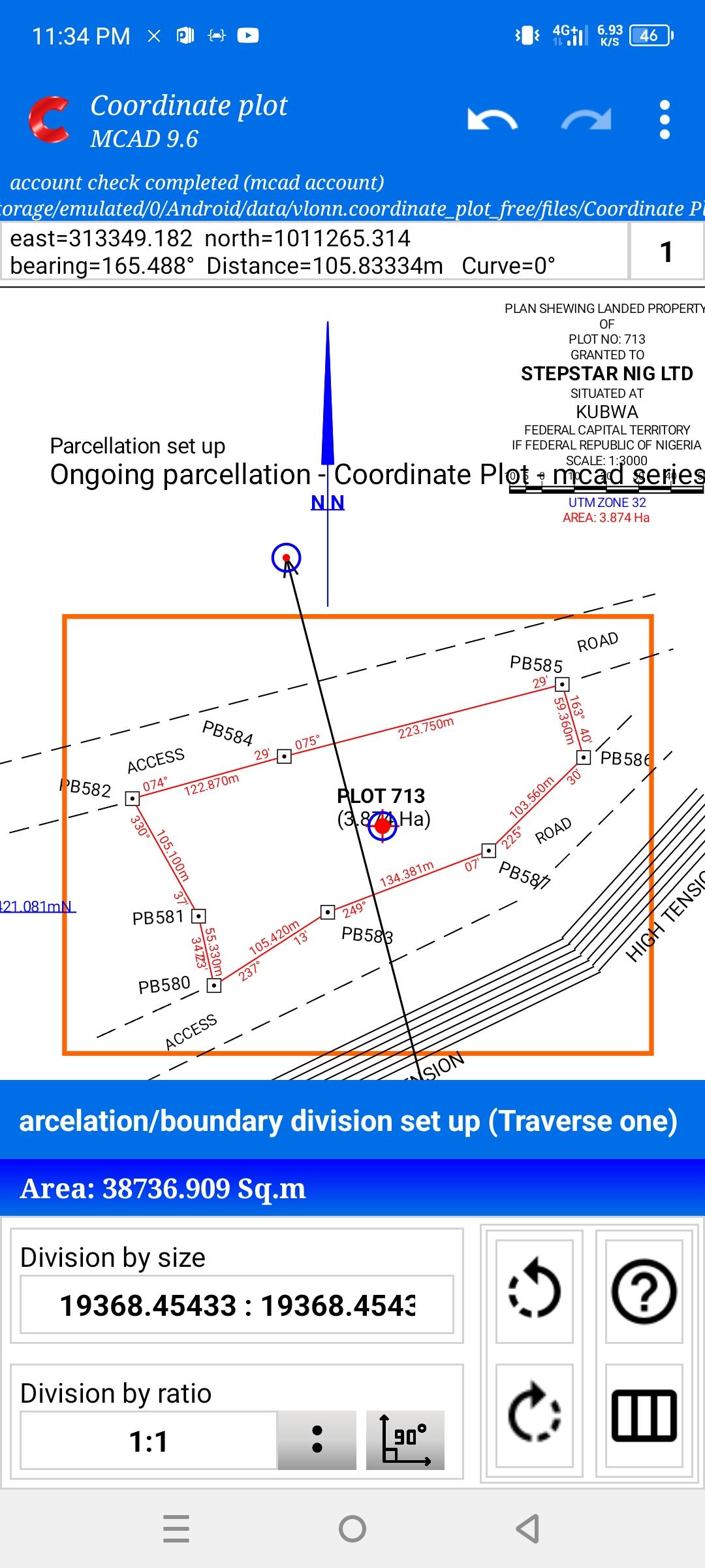
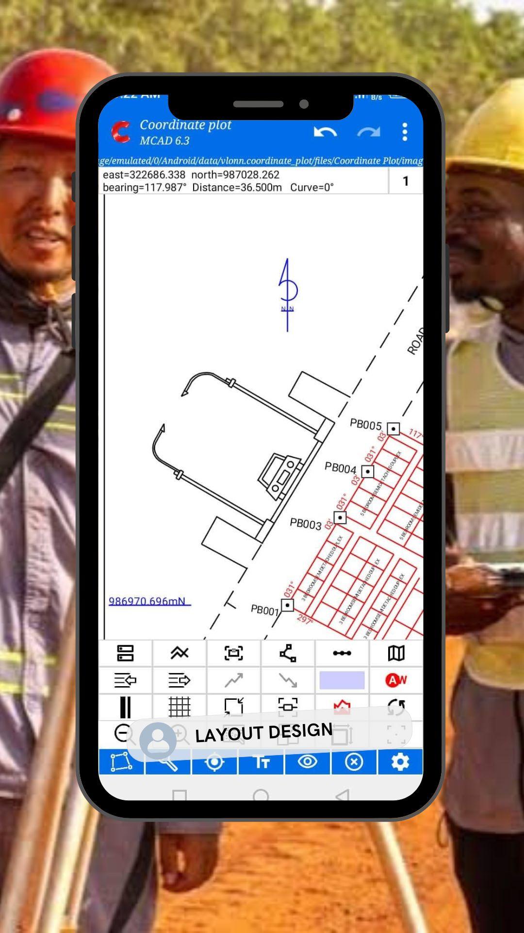
★ Automatic generation of full professional survey plans from field coordinate data entered by the surveyor
★ Automatic parcellation of land into plots of any division defined by the surveyor, with accurate coordinate generation for staking out
★ Automatic area adjustment while maintaining original boundary shapes
★ Back computation of coordinates for verification and correction
★ Professional output and exports:
Print survey plans in PDF format
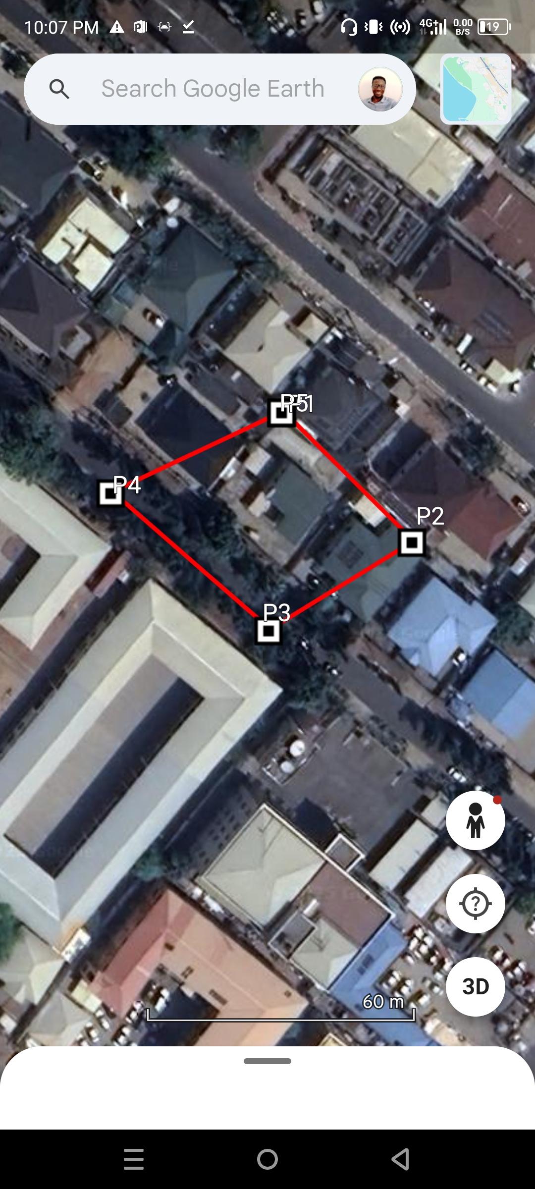
Export data to KML and CSV
AutoCAD (DXF/DWG) export – coming soon
All outputs are driven by user-provided survey data, ensuring that professional judgment, control, and standards remain in the hands of the surveyor.
Latest Version
MCAD 21Uploaded by
Dheibdy Almeida
Requires Android
Android 6.0+
Category
Free Productivity AppContent Rating
Everyone
Security Report
Report
Flag as inappropriateLast updated on May 2, 2026
Added automatic road production in the plan.
Added features for fast survey plan production
APKPure - A multi-platform app store primarily focused on Android, providing extensive app-related content. Discover the app you want easier, faster, and safer, with quick and efficient downloads and installations.


