Use APKPure App
Get The Mississippi Delta AR old version APK for Android
A Landscape in Peril as seen through Augmented Reality
Instructions for use:
Launch the app, allowing access to the camera and media. The start menu displays three augmented reality (AR) visualization links, or 'scenes.' Select the scene corresponding to the open Plot pages. Direct your camera at the open pages, moving your phone or Plot journal around to study the AR pop-up at almost any angle. (You'll notice it works best when at least a part of the open pages are in sight of the camera. Sometimes if a scene doesn't appear, you can go back to the menu and relaunch.) Select the 'Menu' link in the upper left to return to the start menu and select a new scene.
Project Description:
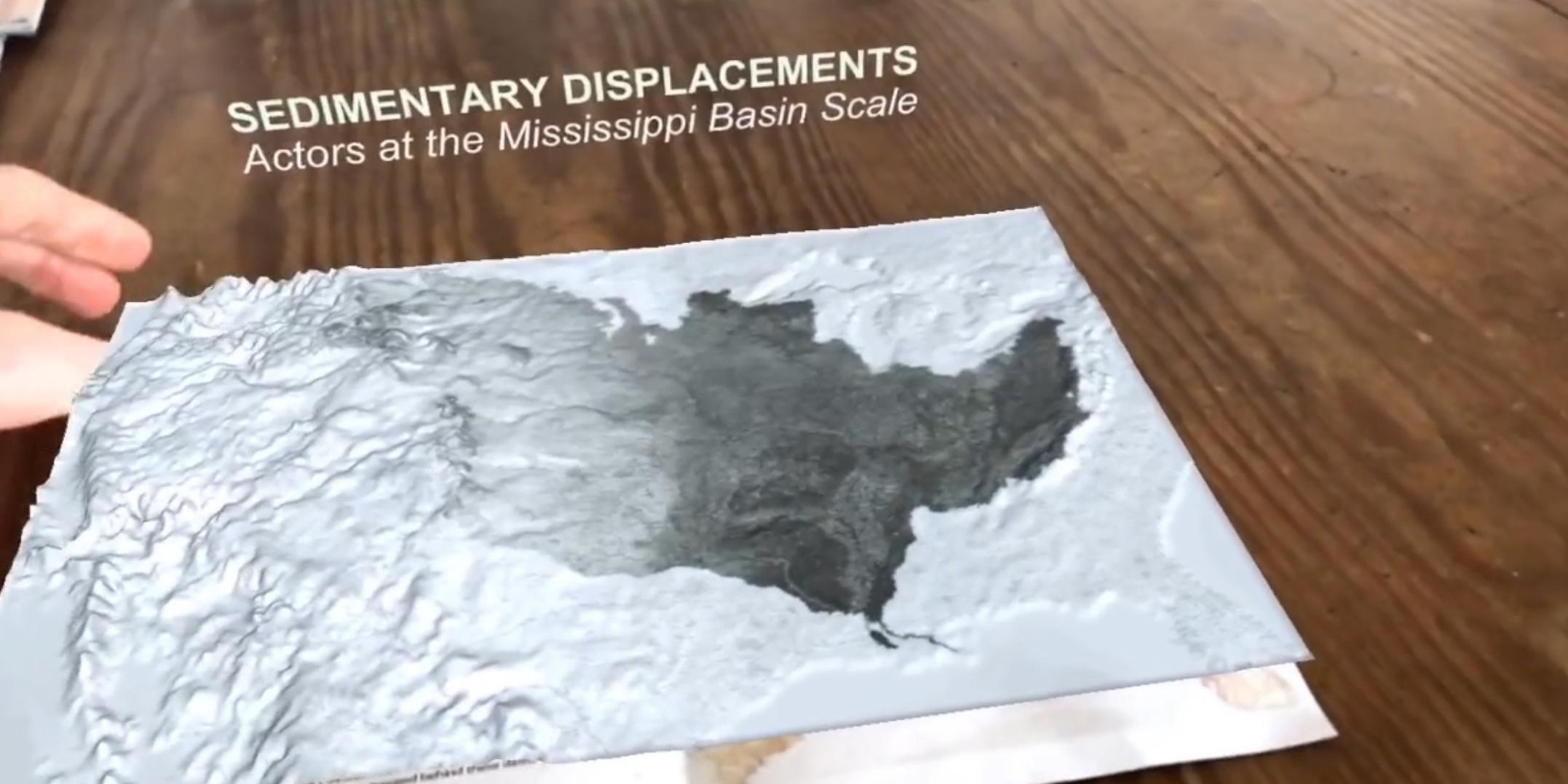
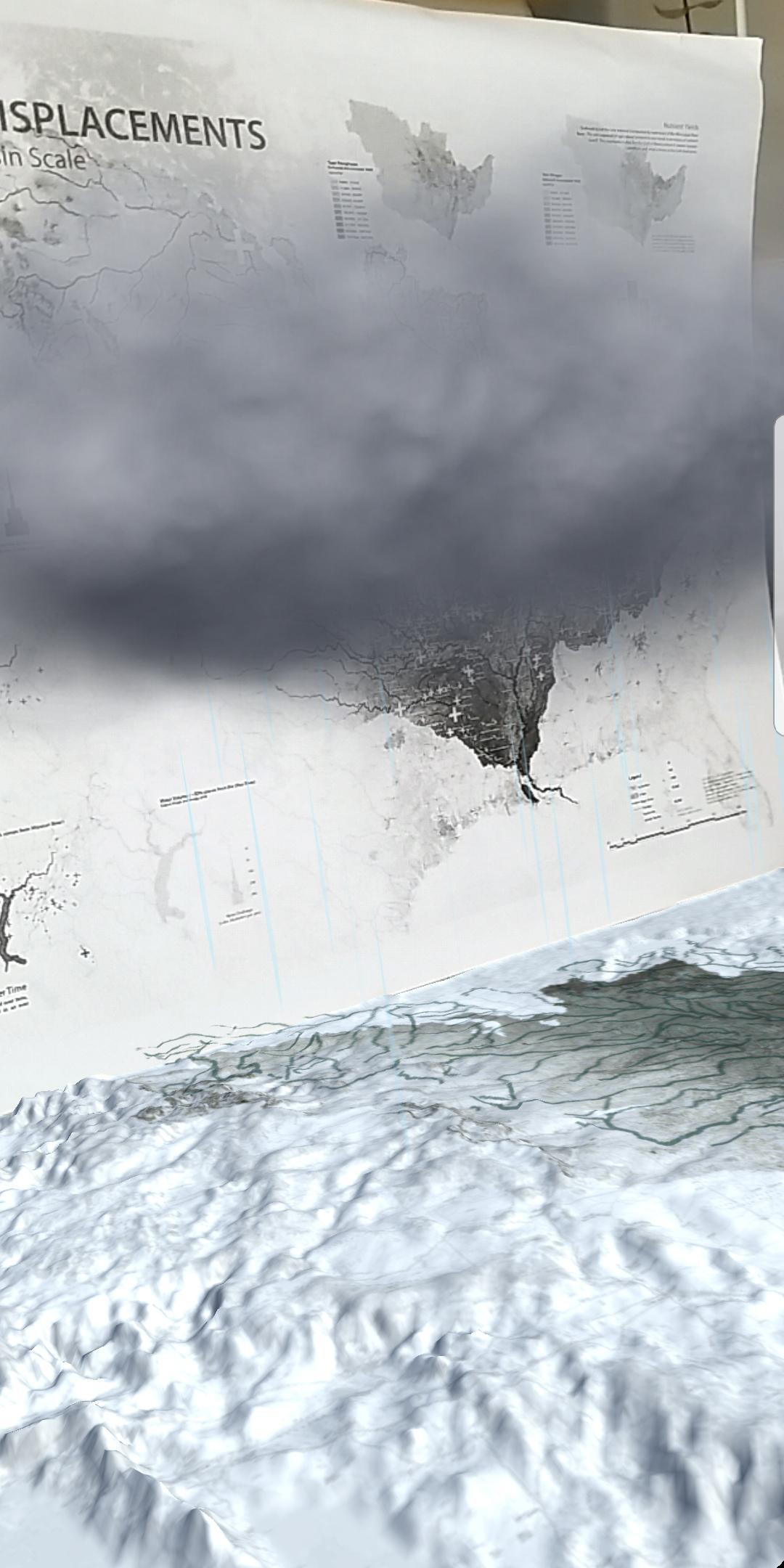
Scales of risk fall across two axes: time and space. The landscapes of South Louisiana are especially illustrative of how large-scale infrastructural responses to spatio-temporal risk often compound and expand risk over both axes, creating vast new emergent territories of peril.
When the U.S. Army Corps of Engineers began working in South Louisiana, it was dealing with a short-term, localized threat: the spring floods of the Mississippi River. It was largely successful in short-term reductions in perceived flood risk, achieved by instituting a paradigm of infrastructural control and constraint. The Mississippi River is now an engineered flow diagram, optimized for ship navigation and flood protection.
This infrastructural control of the Mississippi River has had far-reaching and unintended feedback effects, producing both rapid, short-term disasters and an extremely large-scale but slower, long-term disaster. In the short-term, flood control produces an illusion of certain safety, which in turn fosters urban formations dependent on the continued functioning of that infrastructure. This places ever-aggregating populations at risk for extreme disaster when those infrastructures fail, such as during Hurricane Katrina. Over the long-term, levees, dams, spillways and control structures have radically altered the flow and flood regimens of the river, starving the delta of sediment and contributing to (geologically) rapid, large-scale land loss that threatens the very possibility of settlement within the region. Virtually all of the land surrounding south Louisiana’s largest city, New Orleans, is projected to erode, subside, and sink into the Gulf of Mexico over the coming century. Both these short-term and long-term disasters demonstrate the expansion of risk in both time and space as natural disaster gives way to infra-natural disaster.
The scalar flexibility of these risks poses great challenges to the continued occupation of a region now dwelling in a near continuous state of emergency. This has not gone unrecognized. The 2012 Louisiana Coastal Master Plan, a product of governmental, public and private collaboration, is a comprehensive emergency survival guide, outlining an experimental attempt—now underway—at sedimentary restoration on a globally-unprecedented scale.
Our mappings visualize the historical, present and planned trajectories of sedimentary and hydrological manipulation that have provided for, threaten, and potentially sustain habitation within a dynamic delta landscape. As emergent risks themselves fall across multiple scales of time and space, so too do our cartographic efforts.
* Originally produced within the LSU Coastal Sustainability Studio, working with the Dredge Research Collaborative (DRC) to prepare for DredgeFest Louisiana, an event which was held in south Louisiana at Tulane University and Louisiana State University from 11-17 January 2014. Text by Rob Holmes, Brett Milligan, and Matthew Seibert.
* Parts published in Landscape Architecture Magazine, August 2014, and Places Journal, June 2015.
* AR pop-up interpretation created by Matthew Seibert and Margaret Mulligan at The City College of New York's Spitzer School of Architecture for the landscape architecture program's annual student-edited Plot Journal in spring of 2018. Narration by Anna Ceraulo
Last updated on Jun 2, 2018
New, updated content.
সাম্প্রতিক সংস্করণ
![]() 2.2
2.2
আপলোড
FahriFauzi
Android প্রয়োজন
Android 4.4+
রিপোর্ট করুন
Discover what you want easier, faster and safer.

The Mississippi Delta AR
2.2 by Landscape Metrics
Jun 2, 2018