下載 APKPure App
可在安卓獲取vTools for Survey (Free)的歷史版本
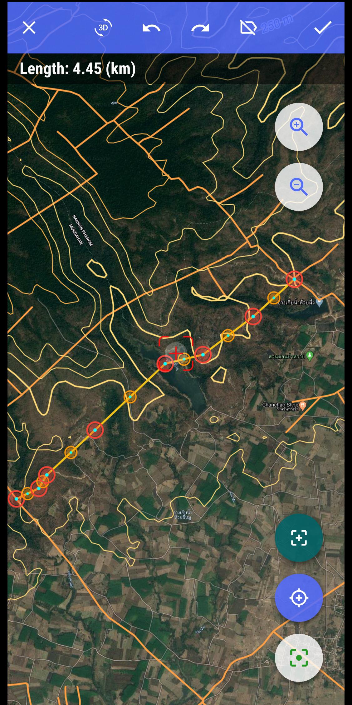
空間數據收集Point,Polyline,Polygon,Tracklog等
The application makes mapping, management planning and field inspection simple, fast and convenient.
Fully integrated with the same functions as a handheld GPS and also adds many new functions to turn your phone into a powerful tool to support surveys, surveys and planning. Field management is the easiest.
The main functions of the application:
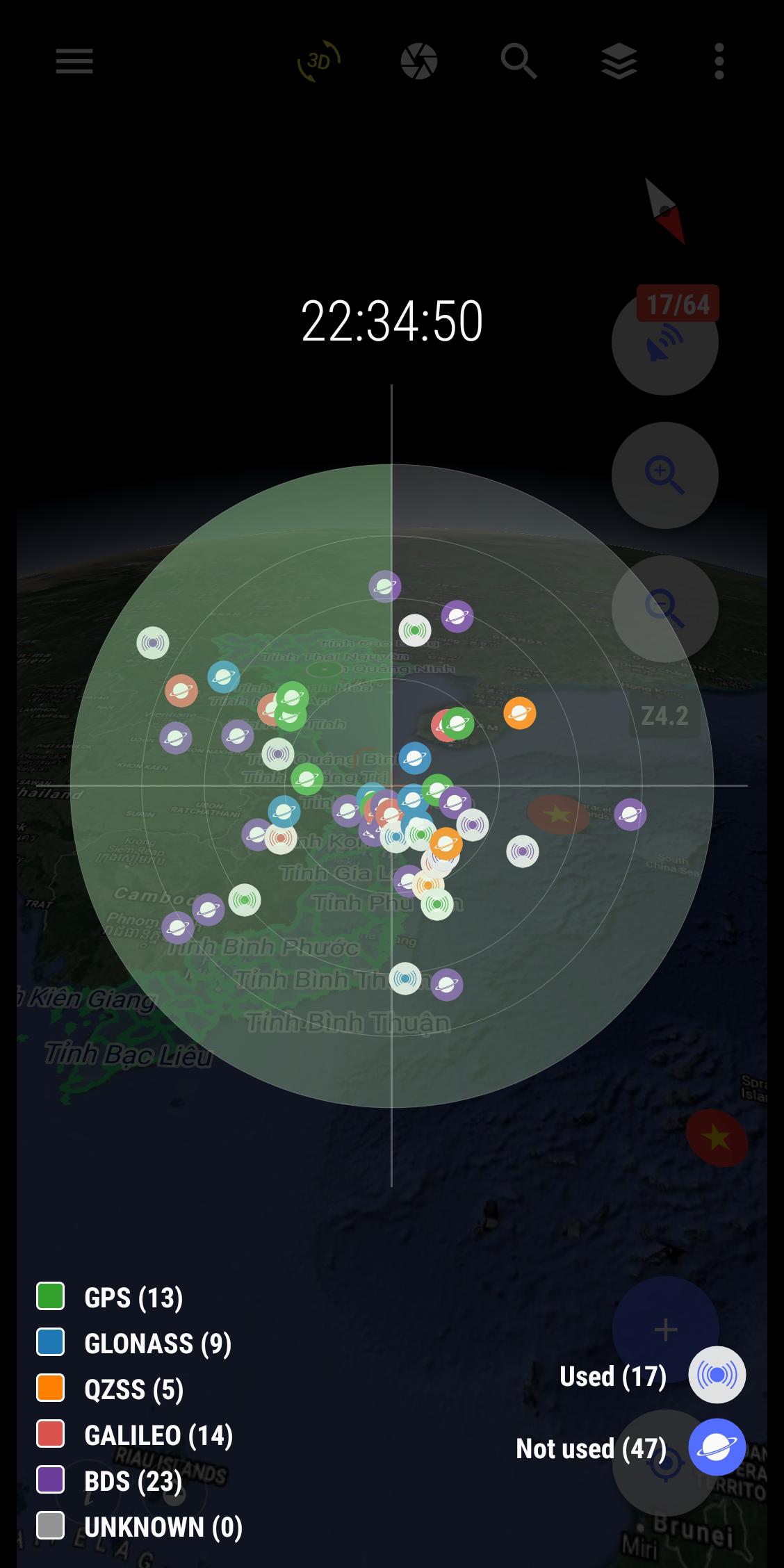
- Positioning, current position, practical view angle in the field. Help identify better directions.
- Allows users to directly create objects (Points, Lines, Zones, Coordinate landmarks, Tracklog routes).
- Allows rapid measurement of the area and length of objects in the field.
- Users can simultaneously create Tracklog, create Point, Road, and Region at the same time while moving. Tracklog mode allows running in the background.
- Support to save attribute information and images in the field.
- Users can define forms, forms or fields to collect. And share quickly to the whole group via QR code or export to file.
- Find for waypoint, enter a list of waypoints from data TEXT(*.txt), Excel (*.xls, *.xlsx), CSV (*.csv) Excel and convert point coordinates directly on the device.
- Allow to enter the list of points to check by hand (For example, it is necessary to check the location of the extract of the red book).
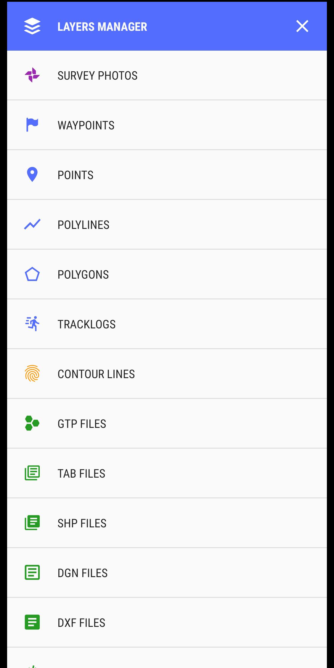
- Support directly opening common data such as Excel, GPS/GPX, KML/KMZ, GeoJSON, AutoCAD DXF, MicroStation DGN, ESRI Shapefile SHP, MapInfo TAB, gCadas GTP
- Support export data to GPX, KML, GeoJSON, Excel, AutoCAD DXF, MapInfo TAB, Shapefile SHP format and share via Email, Drive, Zalo, Facebook etc.
- Fully support the VN 2000 projection system of the local and nationwide of Vietnam.
- Support more than 5000 projection systems of other countries and territories in the world.
- Support for old projection systems like Hanoi 1972 (HN 72).
- Support numerical compass feature
- Support reading offline map data MBTiles and intelligent management of data layers.
- Support with simple MBTiles convert tool on Desktop, help to view properties directly from MBTiles layer.
- Support conversion of TCVN3, VNI encoding for Vietnamese font in viewing attribute information.
- Support field photography, save location, shooting direction on images and Exif information, GeoTag
- Allow users to download Google, MapBox, Bing, ESRI, OSM directly on the computer for offline use.
- Support web map service TMS and WMS.
- The feature allows users to directly find and use Landsat 8 satellite image data (16-day update cycle) and Sentinel 2 (5-day update cycle) from the image database.
If you need assistance please contact us at the following information:
Facebook: https://www.facebook.com/vToolsForMapInfo
Email: vtools.cskh@gmail.com
Phone (Zalo): (+84) 96 990 4596
All Rights Reserved. Copyright © 2020
Last updated on 2020年10月30日
Update version v4.1.2
- Update the information entry form interface
- Some minor changes to the interface for layers manager
- System optimization


vTools for Survey (Free)
4.1.2 by vTools Apps
2020年10月30日