Используйте приложение APKPure
Историческую версию NexDrone - GeoSpatial FieldApp можно получить на Android
Включите любую форму осмотра, застройки- или технический чертеж в геопространственной App
WHAT IS NEXDRONE?
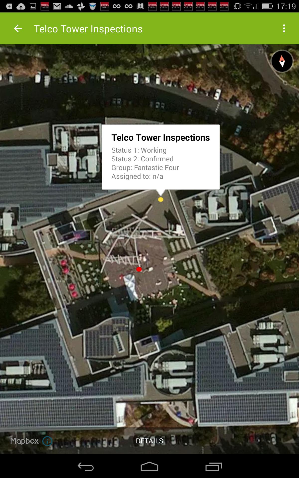
NexDrone is a customizable hosted GeoSpatial platform for hosting maps and digital forms that our consultants develop to fit your business requirements. We design your forms based on your current paper-based forms or digital inputs and deploy them to your mobile field teams. Your field teams can then collect information such as GPS Position, Text, Selection Lists, Photos, Videos, Signatures, Barcodes, and more. No more pen and paper needed. Everything will be recorded as is and synchronized with the server and all other linked mobile devices.
You can combine and superimpose your collected field data with any type of raster or vector map such as:
- drone maps
- satellite maps
- building plans (e.g. Autocad exports)
- technical drawings
- or any kind of raster map or drawing
WHO USES NEXDRONE?
Our clients include Inspection / Construction Companies, Golf Clubs, Farms, Building Managers, Asset Management Companies. Any type of businesses that manages people or assets across large areas can benefit from NexDrone FieldApp. NexDrone FieldApp can record any data from the field with full offline data collection support and offline maps. NexDrone can be used as a standalone geospatial collection platform or can be integrated with all major existing GIS and planning tools such as MapBox, CartoDB and Autocad, .
Last updated on 17/06/2020
- Annotations synchronization
- Bug Fixing
Последняя версия
![]() 1.2.8
1.2.8
Загрузил
Hassan Albsrawi
Требуемая версия Android
Android 5.0+
Available on
![]()
Категория
Жаловаться


Discover what you want easier, faster and safer.

NexDrone - GeoSpatial FieldApp
1.2.8 by NexDrone
17/06/2020