Use APKPure App
Get Locus GIS old version APK for Android
GIS application - offline data collector, mapper, area calculator and SHP editor
Professional GIS application for offline fieldwork with geodata. It provides data collection, viewing, and updating. All its features are available above a wide selection of online, offline, and WMS maps.
Fieldwork
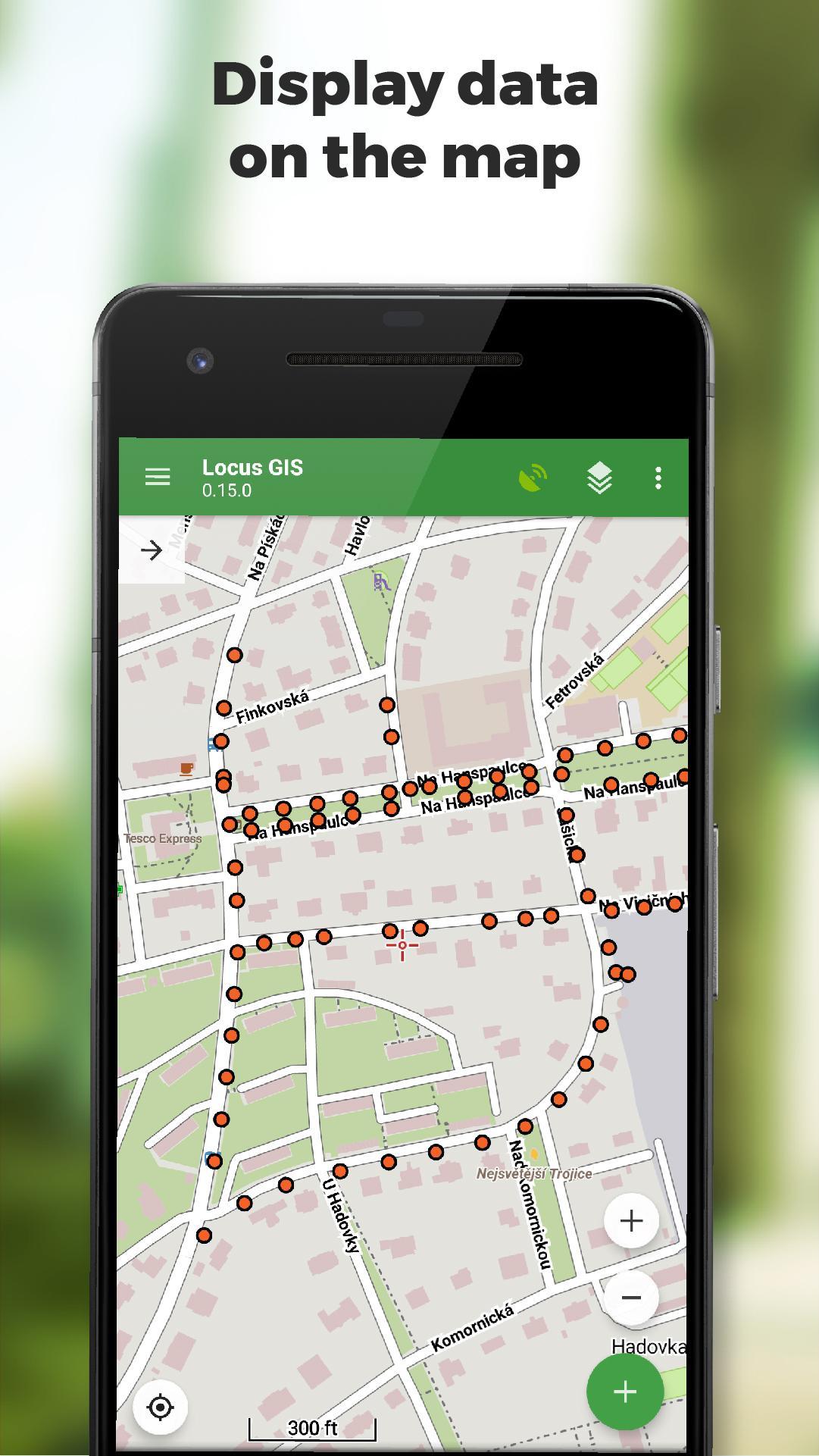
• offline collecting and updating of field data
• saving points with current or arbitrary position
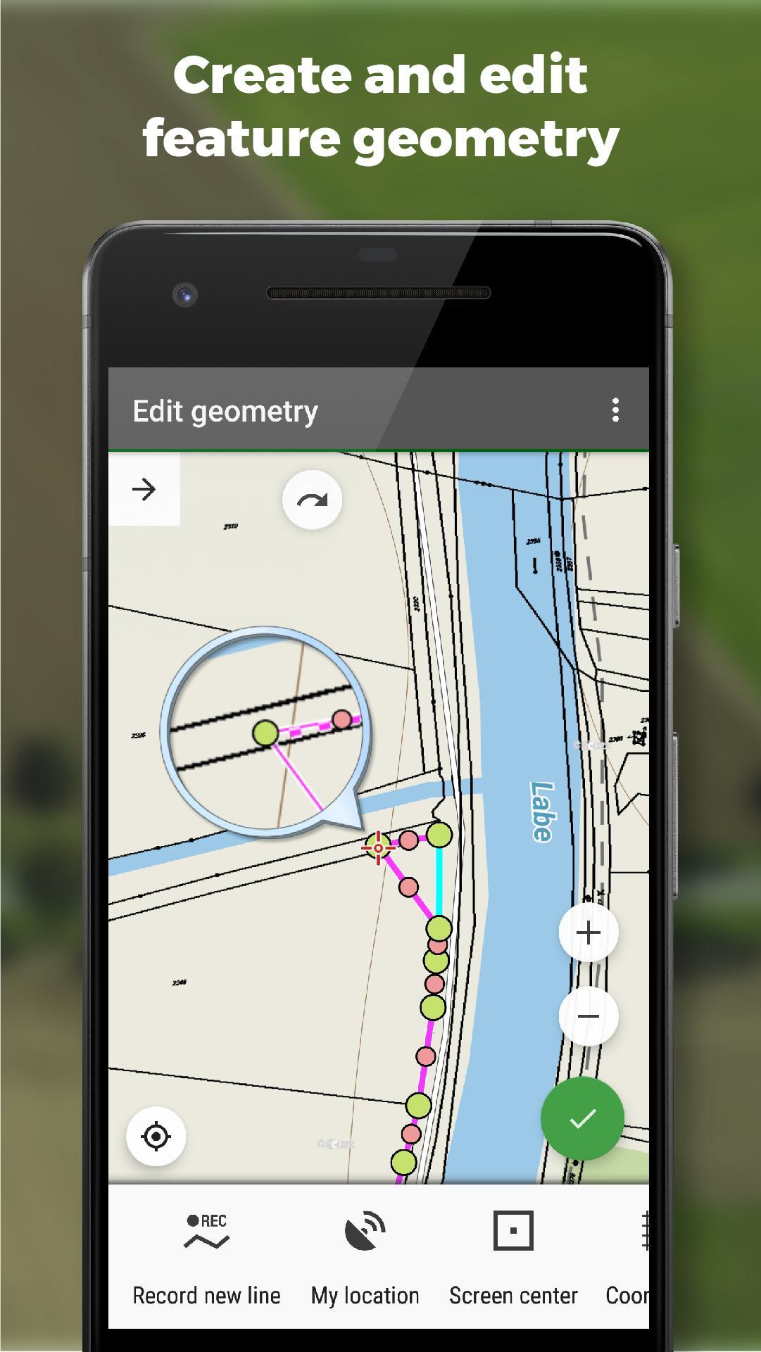
• creating lines and polygons by motion recording
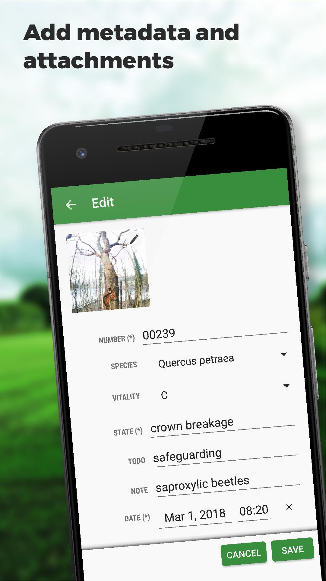
• settings of attributes
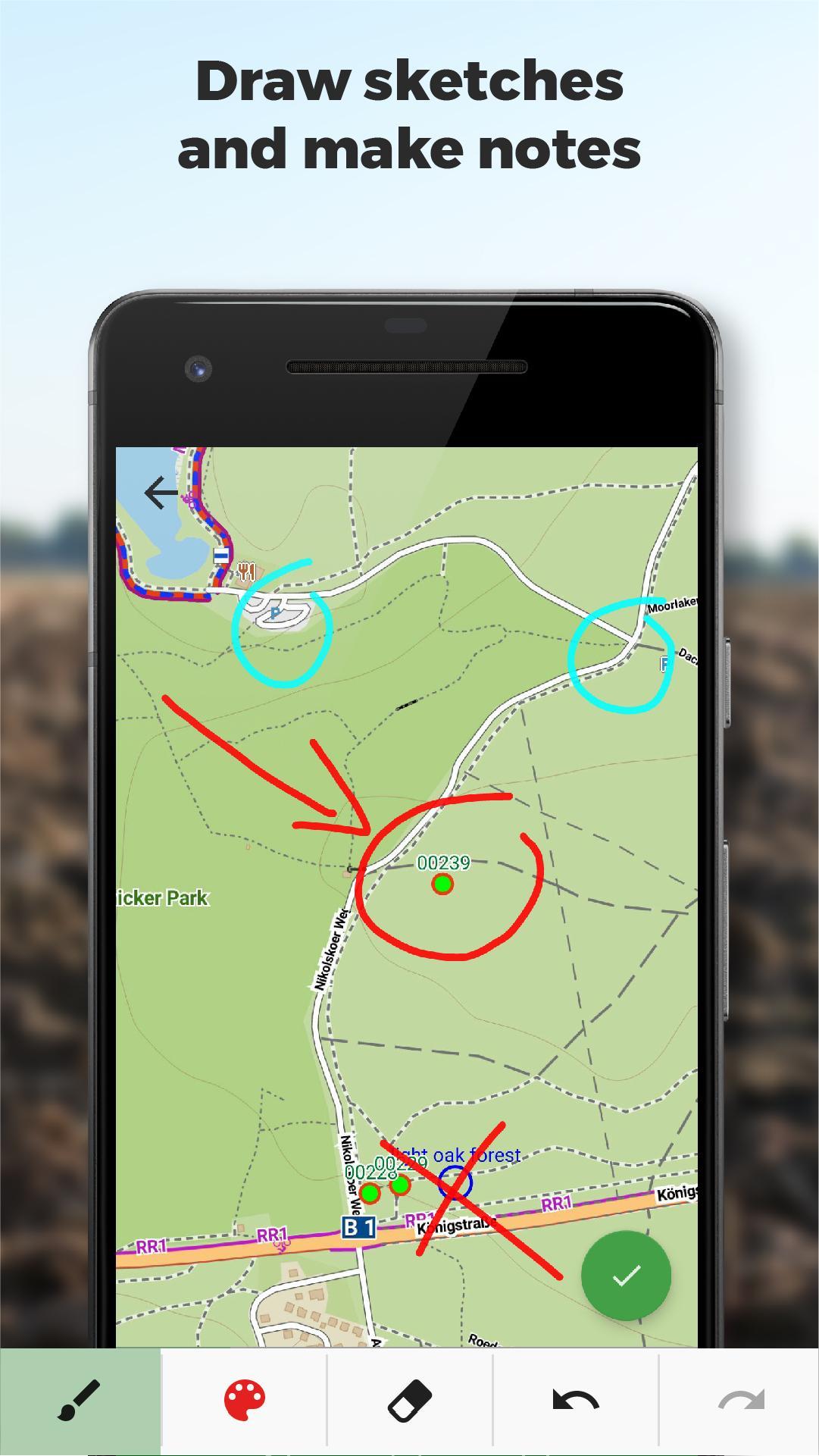
• photos, video/audio or drawings as attachments
• guidance to points
• collecting location data for polygon/line recording or guidance on a target, even when the app is running in the background
Import/Export
• importing and editing ESRI SHP files
• exporting data to ESRI SHP or CSV files
• exporting whole projects to QGIS
Maps
• wide range of maps both for online use and for download
• support of WMS sources
• support of offline maps in MBTiles, SQLite, MapsForge, TAR, GEMF, RMAP formats, and custom OpenStreetMap data or map themes
Tools and features
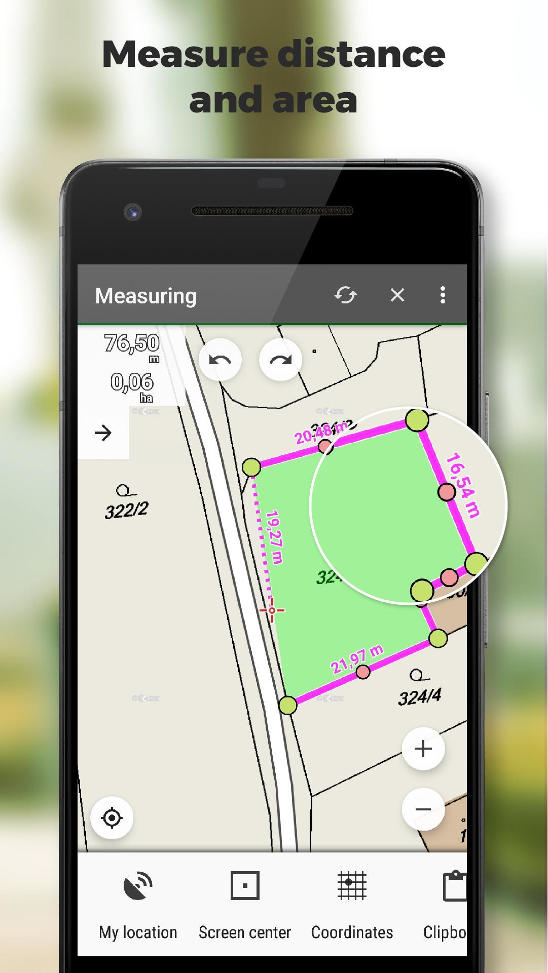
• measuring distances and areas
• searching and filtering of data in the attribute table
• style editing and text labels
• organizing data into layers and projects
Locus GIS is successfully used in a wide range of industries:
• collection of environmental data (ecological scanning, tree surveys ...)
• forestry management and planning,
• agriculture and soil management
• gas and energy distribution
• planning and construction of wind farms
• exploration of mining fields and location of wells
• survey and management of urban facilities
• road constructions and maintenance
Last updated on Mar 28, 2024
*** 1.22.2 ***
- add: a brand-new manager for GNSS external devices
- add: NTRIP client (currently in beta testing)
- add: ability to choose multiple options for enumeration attributes
- add: a completely new system for managing accuracy tolerances and warnings
- add: edit the starting number in the auto-numbering sequence
- add: option to add several independent WMS layers from a single WMS service
Latest Version
![]() 1.22.2
1.22.2
Uploaded by
ნი ნა
Requires Android
Android 5.0+
Available on
![]()
Category
Report


Discover what you want easier, faster and safer.

Locus GIS
offline land survey1.22.2 by Asamm Software, s. r. o.
Mar 28, 2024