Use APKPure App
Get SEEM(Solar Energy Estimation MAP) old version APK for Android
Die App ist voll mit Karten für Jammu, Kaschmir und Udar Pradesh Solar Designer.
Goal of my research is that the designing for particular household or small industry who wants to install these PV in any application should be as accurate and easy so that cost estimation of installation be accurate and money can be saved while designing.
To achieve this goal i have used curve fit model for india which can estimated daily solar incident energy for any place of country .And its accuracy is tested for Srinagar city of Jammu and Kashmir state by making experimental model .After that whole state PV(Photovoltic panel ) estimation parameters which are essential while designing is to be mapped using google map,google cloud and MATLAB finally PV based pump designing for state of uttar pradesh is to mapped in same way for varying suction head of water below ground level .
Purpose of this mapping:-
The maps below has two featured element namely
1.HAT_min(Minimum Daily solar incident energy on the surface considering all atmospheric effect throughout the year) This parameter is very essential for designing the solar panel size at any particular place
2.The map is of na(Number of battery backup days required)
This parameter is very essential in designing the size of battery for any place and decides the overall cost of installation.
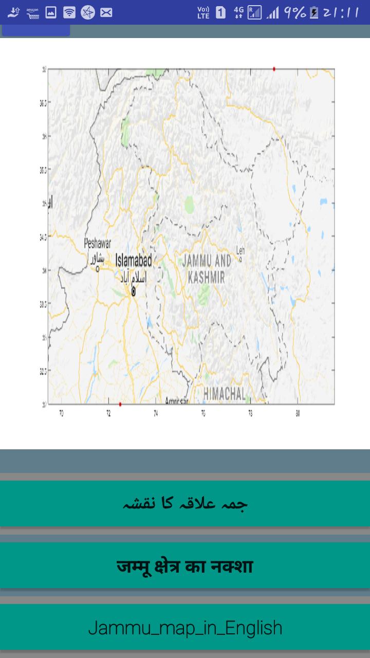
For clarity of Google map projection we have divided J&K state into three regions
1.Jammu
2.Kashmir
3.Ladakh
Note:-na is been obtained after obtaining 11 years of All_sky solar insolation data from Nasa’s satellites for the different places.
Note :-Overall efficacy of this model is been tested for place at NIT Srinagar over live accumulation of data for one month ….You can read the full report of experimental setup at the following link
https://docs.google.com/document/d/1VooevNIv40eizeYCr76KTmuWDOP_gTJg3mPYapwjvLo/edit?usp=sharing
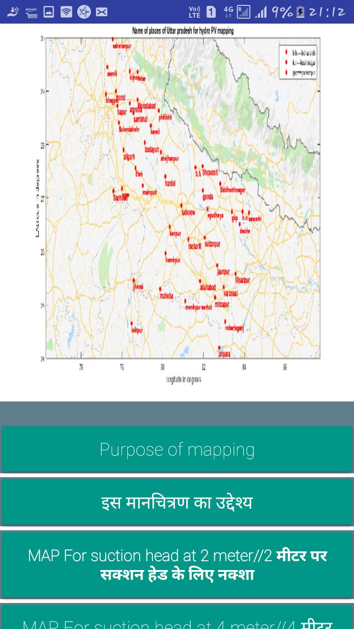
Irrigation sector application for Uttar Pradesh state:-
Purpose of this mapping:-
Uttar Pradesh being the populous state of our country and water is most important for this state and from recent government report suggest that water table in whole state is residing and being agriculture state it is very important for them to irrigate .
So in that perspective there is need of energy to pump the water below ground to earth . Conventionally diesel pump is what farmers are using .
Indian government invest lakhs of thousands of crore subsidy to farmer for the diesel oil.But we know this use of diesel pumping puts huge burden on the government oil import and also pollutes the environment .
So to solve this government has proposed use of solar based pump system and provides huge subsidy n that despite that it is not being used by farmers .
Here what we attempt is to help the rural designer in designing the solar panel size and pump size from samples of 45 districts of state for varying water level for one place from 2 meter below the ground to upto 60 meter approx 200 feet maps for sizing PV panel and pumps ,motors are mapped .
Assumption:-
Here we have assumed rice crop to be watered and under normal monsoon condition which requires approx 1 lakh liter water during cropping season which is maximum and for all 45 places Map with data of sizing panel ,sizing motor,sizing pump at suction head from 2 meter to 42 meter around 200 feet is been prepared .
Below image is used while making relation on design the pump to panel size
How to use the sizing map:-
Step 1.Just go to the place where you reside or by longitude and latitude .(see the first map which has names of places)
Step 2:-Now go for the suction head which you require say someone need suction need of 20 meter for his place ,than go to app section >>select utter Pradesh>> download the maps of that suction head.
step 3):-Now just see the place note down the panel size , pump size of that place at that suction head.
Last updated on May 17, 2019
Minor bug fixes and improvements. Install or update to the newest version to check it out!
Aktuelle Version
![]() 1.2
1.2
Erforderliche Android-Version
4.4 and up
Available on
![]()
Kategorie
Bericht


Discover what you want easier, faster and safer.

SEEM(Solar Energy Estimation MAP)
1.2 by FREE INFOTAINMENT
May 17, 2019